

We arrived in Harrison, Arkansas in early May 2021. During our 3-week stay we explored the Ozark Mountains while battling unprecedented rainfall and unseasonably cold temps.
Regardless of the inclement weather, we managed to fit in lots of fun adventures ranging from small towns, local attractions, bike riding (see post on Eureka Springs), to River rafting (next post will be on Buffalo River floats), to a wide range of hikes.
This post will focus on our recommended hikes which range from less than a mile to a max of seven miles. From very easy to moderate. A little something for everyone.
Enjoy our highlights and recommendations from this little slice of heaven in this northwest part of Arkansas.
HIKING:
Over the years, we’ve become big fans of the AllTrails App and use it regularly. A secret to ensure that you can access the map when you don’t have cell service is to mark a trail as a favorite and download the map before you leave the house.
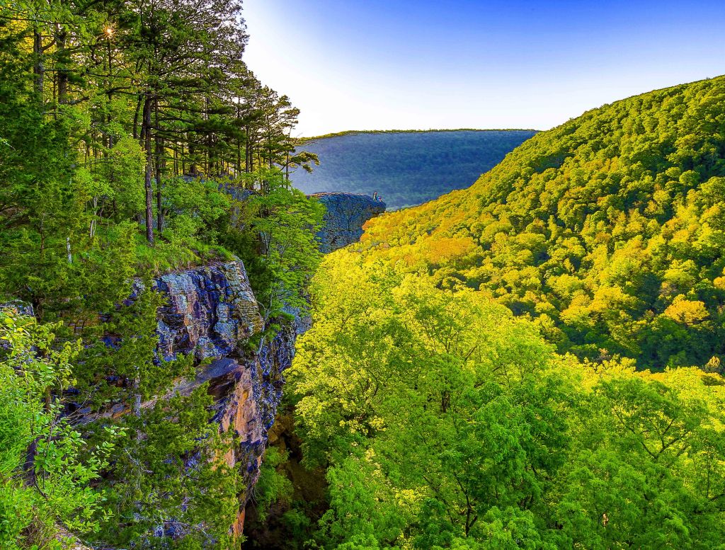
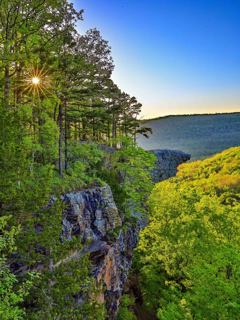
Hawksbill Crag via Whitaker Point Trail – Pettigrew
A short easy hike with big rewards. First you must drive on a 6 mile dirt gravel road to get to the trailhead. The trail has both an overlook and a waterfall. Get an early start for a sunrise photo. AllTrails details here.

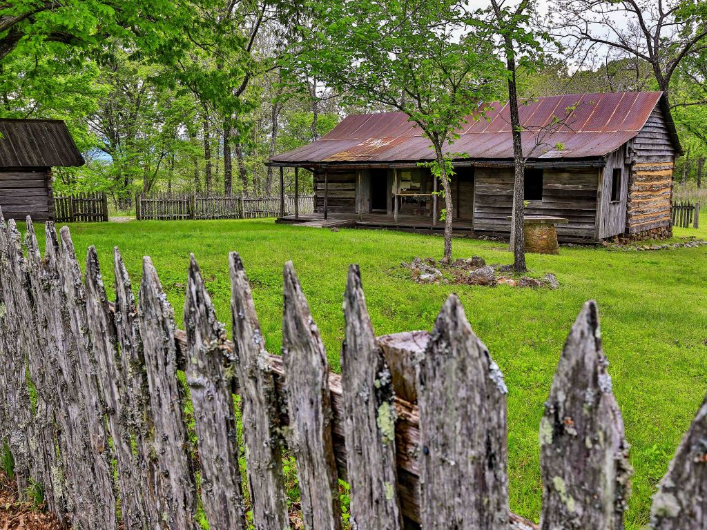
Tyler Bend Visitor Center – Between St. Joe and Marshall
This short 2.1 mile hike features the Collier Homestead and a fantastic view of the Buffalo River. Sunset is a good time to go. AllTrails details here.
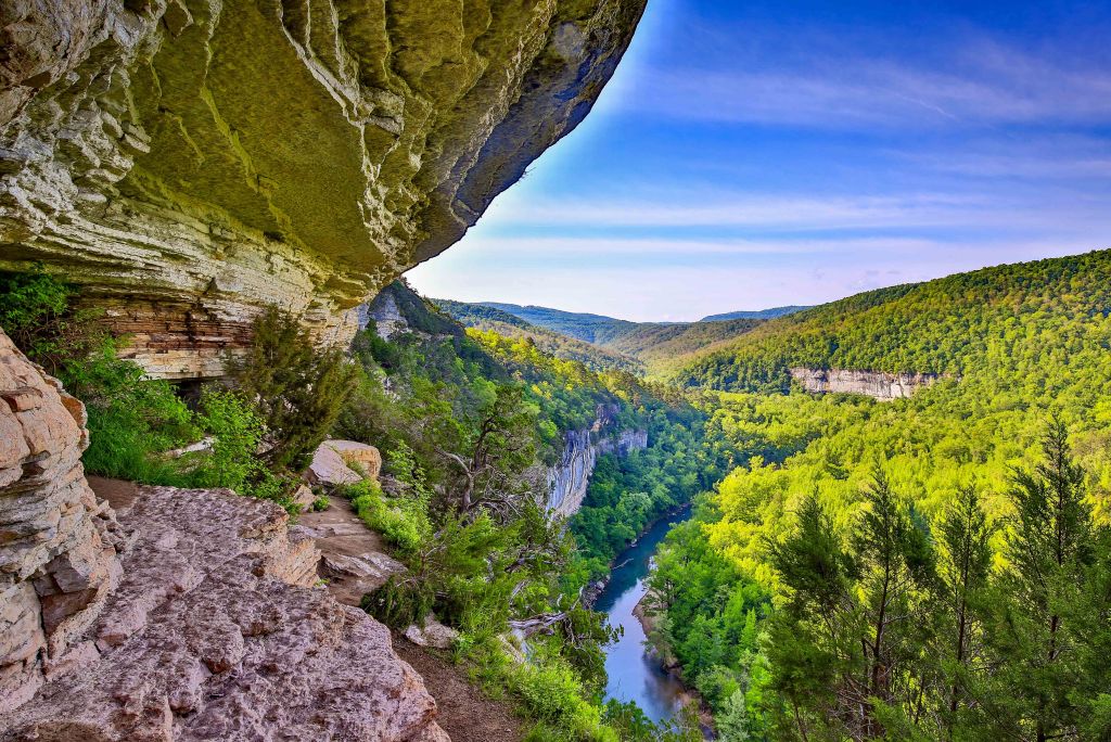
Centerpoint to Goat Trail – Ponca
You will quickly see how this moderately rated 6 mile round trip hike is one of the most popular trails in the Ozarks. The destination is the Big Bluff overlooking the famed Buffalo River. At 500′ tall, it is considered the tallest along the Buffalo. The Goat Trail is the narrow ledge that spurs off and is named for the feral descendants of domesticated goats (brought here by pioneers) who either escaped captivity or were turned loose and eventually became wild. AllTrails details here.

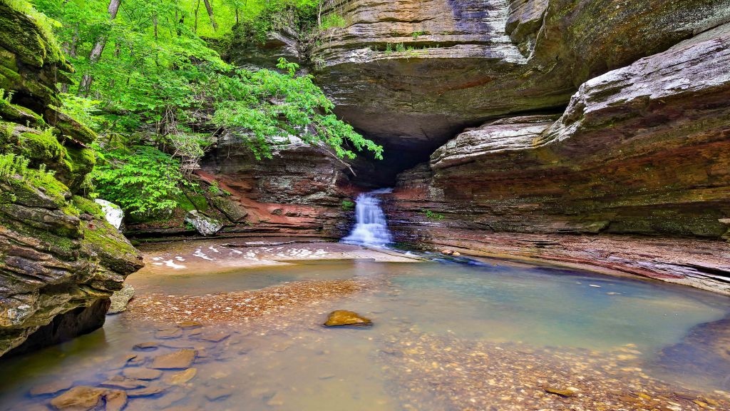
Lost Valley Trail – Ponca
Short easy hike to two waterfalls and a cave. Details from AllTrails here.

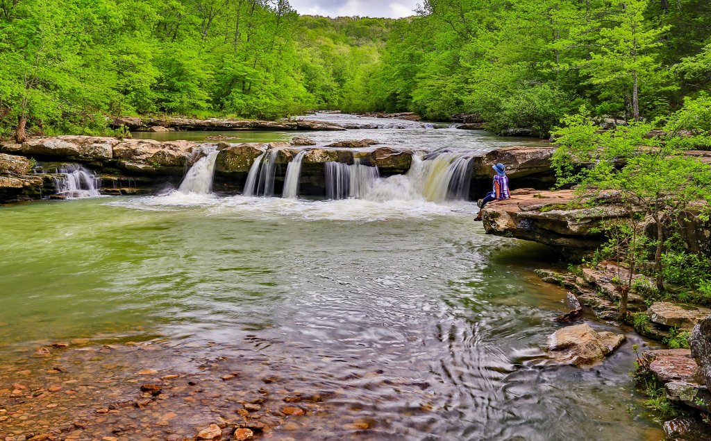
Kings River Falls – Wittaker
This is an incredibly long drive from Harrison especially when you include the 7’ish miles of gravel/dirt roads,. It would be a shorter distance if you were staying at Ponca or Jasper. Regardless, the walk along the river is short and sweet and the falls have lots of areas to dip your toes in the water and relax on the rocks. AllTrails details here.


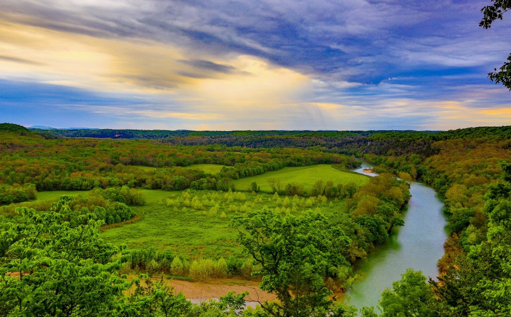
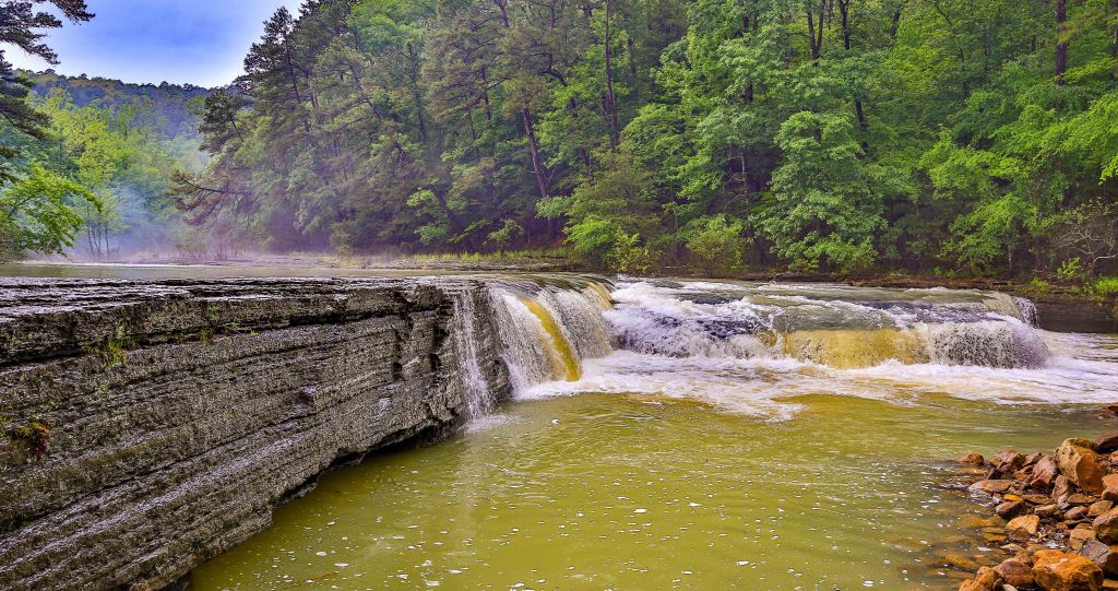
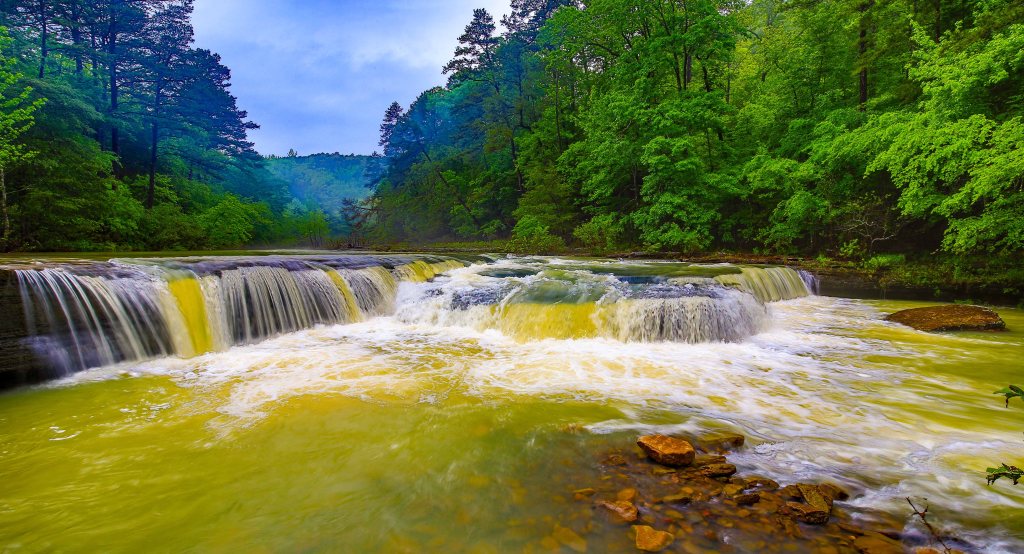
Overlook – Red Bluff Overlook – St Joe
From the Gilbert General Store it’s a short drive [Google Map directions here] to this eagle eye view of a bend in the Buffalo River between Gilbert and Maumee South.


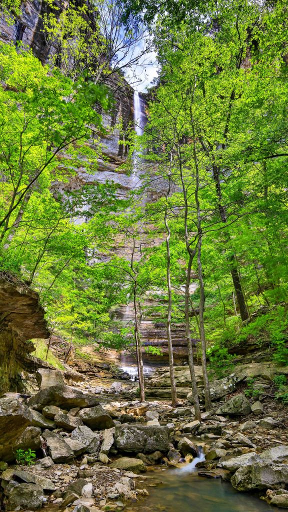
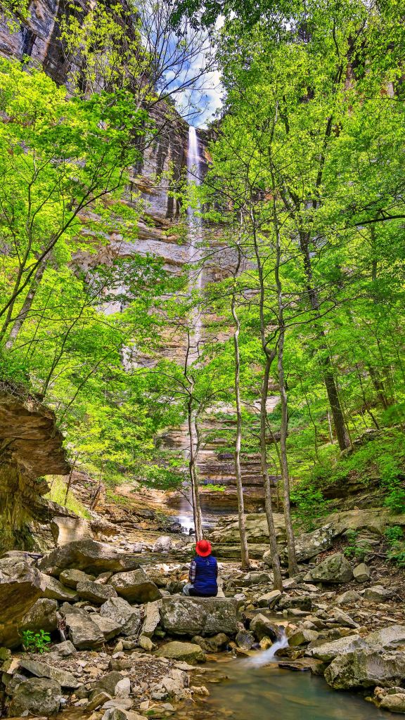
Hemmed In Hollow Falls – Compton
The highest waterfall between the Appalachians and the Rocky Mountains is located in Arkansas along the Buffalo National River. This beautiful 209′ tall waterfall and its surroundings is a MUST SEE. I hear that from the regular trail head it’s a pretty tough hike. that starts in the hills above the top of the falls and ends at the bottom of the falls. I can see that the tough uphill climb out would be difficult.
But there is good news! There is a short easy trail that can be accessed from the Buffalo River which is how we accessed the falls for these beautiful pictures. To plan a float trip down the Buffalo, you will have to wait until water conditions are right, float from either Ponca or Steel Creek to Kyle’s Landing on the upper Buffalo and diligently look for the access point to the trail in the middle of Horseshoe Bend.
AllTrails link here.

Triple Falls [aka Double Falls] – Jasper
Located on the Boy Scout reservation which is off limits to the public, generally the falls are open to the public with nice new signage and no warnings to keep out. Always be respectful of the land. Leave no trace – what you take in – take out.
AllTrails info here.

Haw Creek Falls – Hagarville
This beautiful scenery is located within the Haw Creek Falls Recreation Area. There are campsites that overlook the area. Awesome picture opportunity as well as a great place for reflection and relaxation.
AllTrails info here.
Pam’s Grotto Waterfall – Hagarville
This 0.8 mile trail can be steep and technical in areas but it is so worth the effort. We happened to catch it after several days of near constant rainfall. We were blown away with this beautiful area. AllTrails info here.


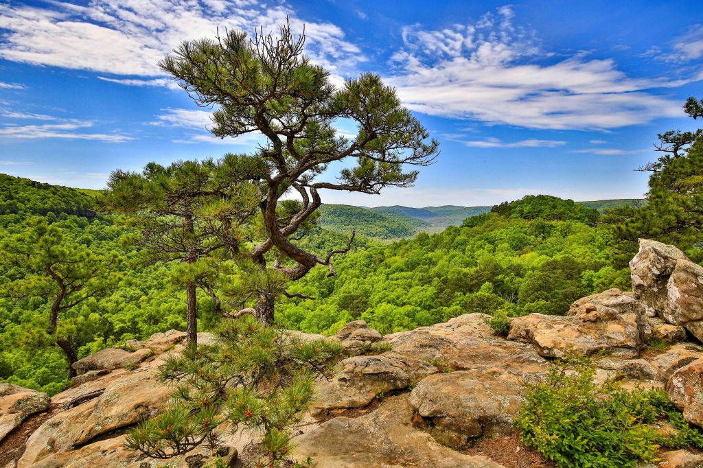
Sam’s Throne – Mount Judea
An easy 2.6 mile loop located on Judea Mountain and overlooks the Big Creek Valley. The scenery was memorizing and we totally understood why this is such a popular hike. AllTrail info here.
Alum Cove Natural Bridge – Deer
This 1.2 mile heavily trafficked trail that features a huge stone arch that forms a natural bridge. The 130′ long, 20′ wide natural arch is all that remains of what was a quartz sandstone cave. AllTrails info here.

Dream Big – Travel Far – Live Well
For all of our Photography, you can find us on Fine Art America, here.
For more timely adventure updates, you can find us on Instagram .
