

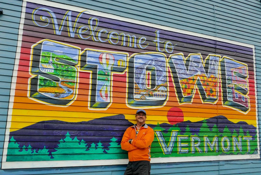
Burlington to Stowe
2022’s Journey will entail 25 Campsites – 4,315 Miles (in Rosie the RV) and countless other SUV miles to get us to our adventures. We will see such vacation hotspots as St Augustine, Savannah, Charleston, Lake Placid, Vermont, New Hampshire, Maine [primarily Acadia National Park, and Baxter State Park], then head south to West Virginia and Virginia before landing back in Central Florida for the winter months.
On June 19th, 12-weeks into our 2022 adventures, we landed in Johnson, Vermont. A small town in North Central part of the state where we will spend 14-days to hike, bike and kayak the region from Burlington to Stowe.
This is long one but think you’ll enjoy the info on the many different adventures in the Vermont area, They are grouped together by Hiking, Biking, Paddling, etc. I hope you enjoy the read.
Campground
Maplewoods Campground and RV Park

Maplewoods Campground is an RV park and campground located in Johnson, Vermont. Nestled into 78 beautiful acres with gorgeous views of the Sterling, Butternut, and Elmore Mountains with spaciousness and breathtaking mountain views. We absolutely loved our site especially the views. The staff was friendly and accommodating and the laundry room was pretty nice. We did not take advantage of the bathrooms; first, they were just very basic and secondly, you had to pay extra to use them. The internet was also an extra cost and was very basic and just barely enough oomph to stream. The location was ideal for us, just outside Stowe, close to hiking and biking and just an hour drive from the bustling city of Burlington.

Hiking
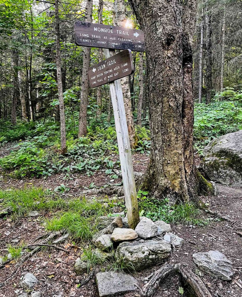
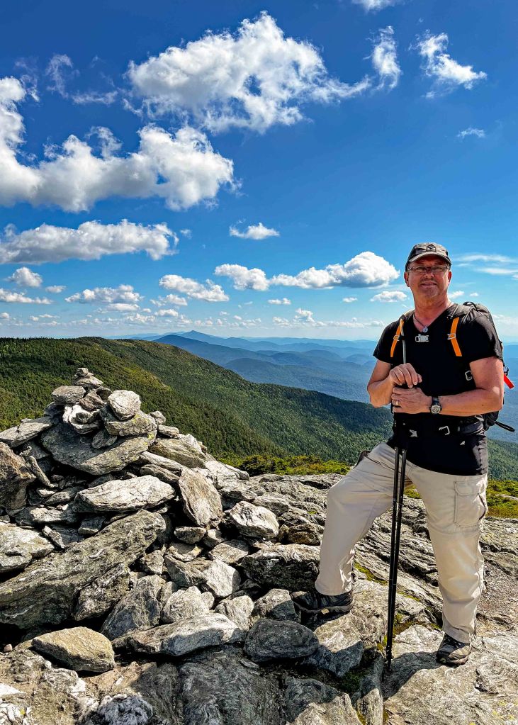
Camel’s Hump via Long Trail
Check out this 7.2-mile loop trail near South Duxbury, Vermont. Generally considered a challenging route, the part that challenged us was the 1.7-miles down from the summit on the Long Trail. We found the extreme downs and the open rock slabs a bit too much for total enjoyment Otherwise, the 7.2-mile hike was awesome! Next time we would just go up and back down the Monroe Trail and skip the Long Trail extreme downs.
We took the AllTrails route:
- Monroe Trail 3.1-miles – Nice steady climb…. loved it.
- Long Trail to Summit 0.3-miles – Gets a little steep but great views
- Long Trail from Summit 1.7-miles – Gets really steep and rocky with lots of downs on open rock slabs
- Dean Trail to Monroe 1.0-miles – It Levels out and becomes a nice walk in the woods
- Monroe Trail to Trailhead 1.3-miles


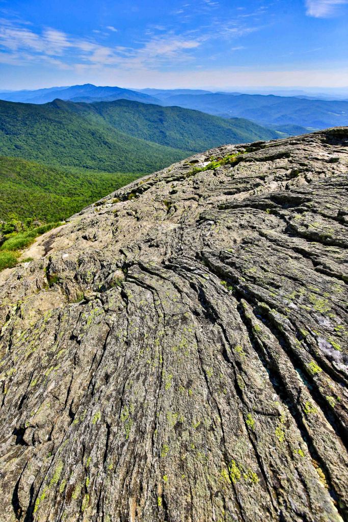
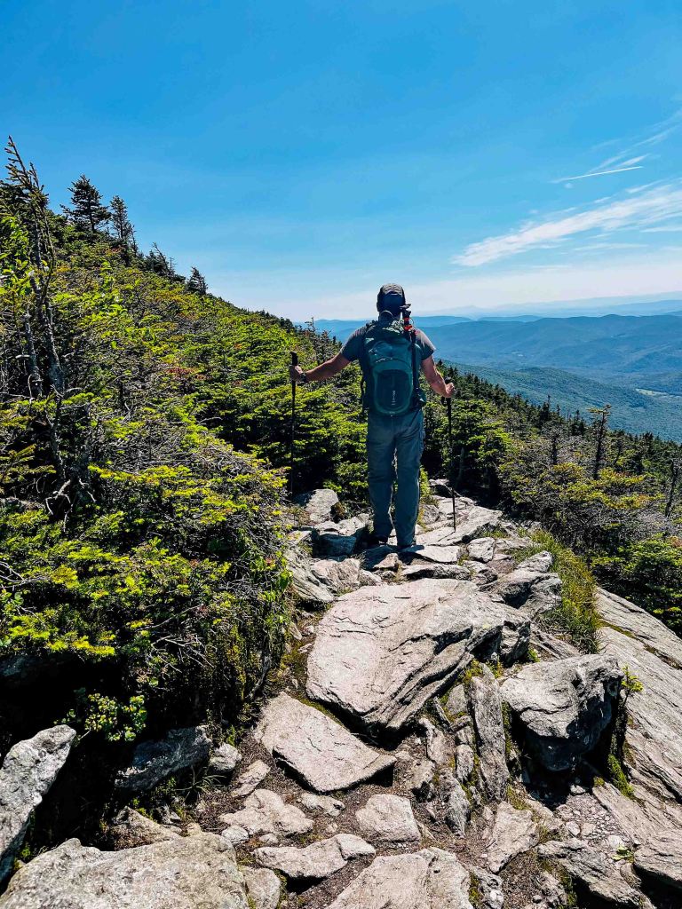

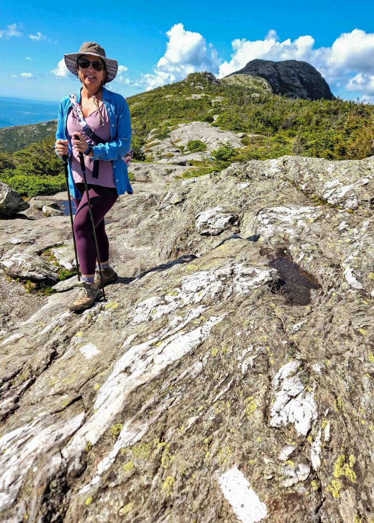
Mount Mansfield Nose to Chin
Imagine this! Atop the highest point in Vermont on a cool crisp blue sky day, views for miles.

Start with a 4.5 mile up the Auto Toll Road in Stowe to 3,380-feet.
After a pleasant informative conversation with a Green Mountain Club volunteer, you don your hiking shoes to hike 1,053 ft UP in a short 1.4 miles to the highest point in Vermont, Mt Mansfield.
This moderate intensity hike is considered moderate and starts by walking through small spruce trees and then quickly emerge into open air with big views.
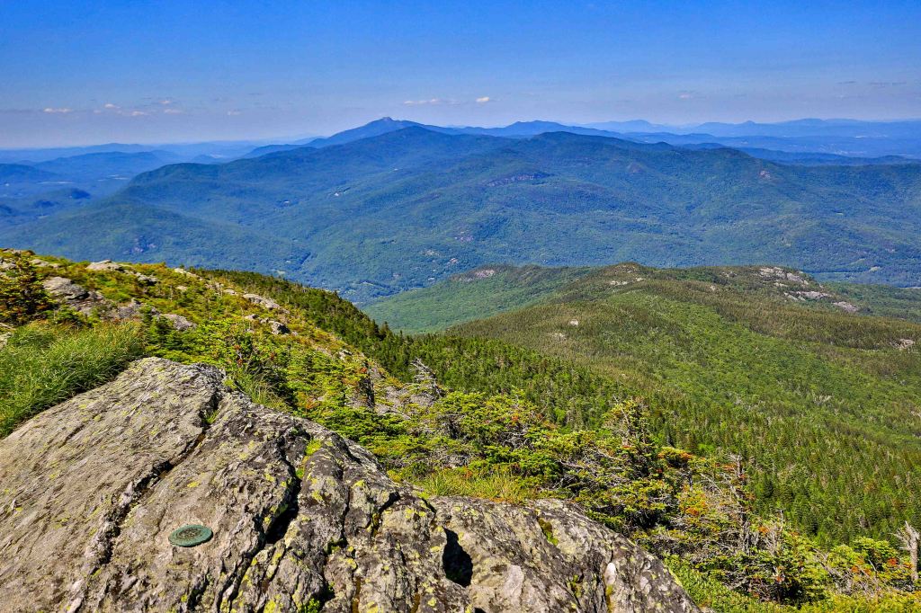
Then, W⭐️W you are on top of the world (or at least Vermont)!
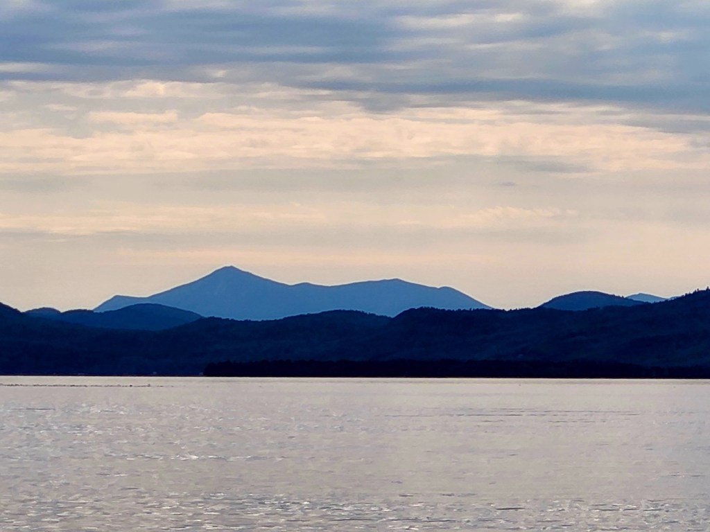
Looking west you see Burlington, Lake Champlain and the Adirondack Mountains. To the east you see the ski resorts, Stowe and other small towns. Looking south you see the Green Mountain range.
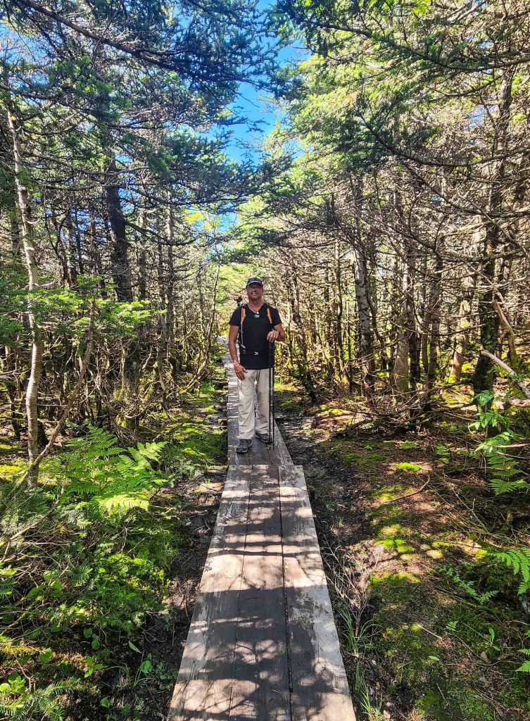

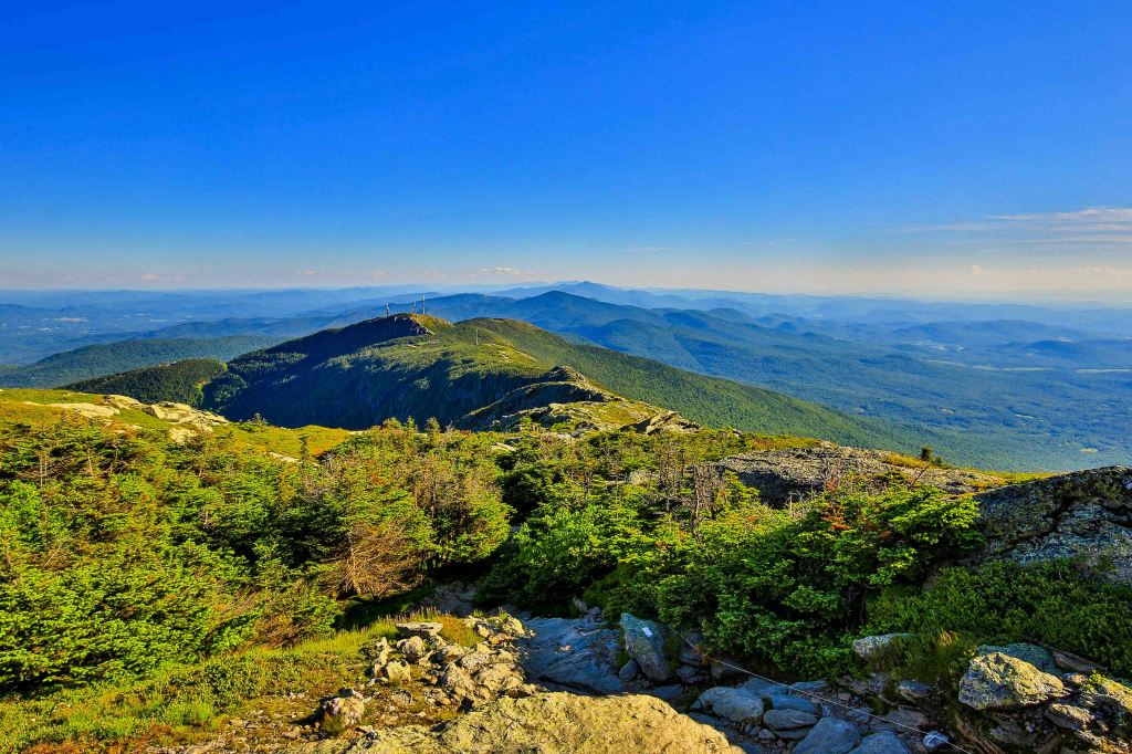
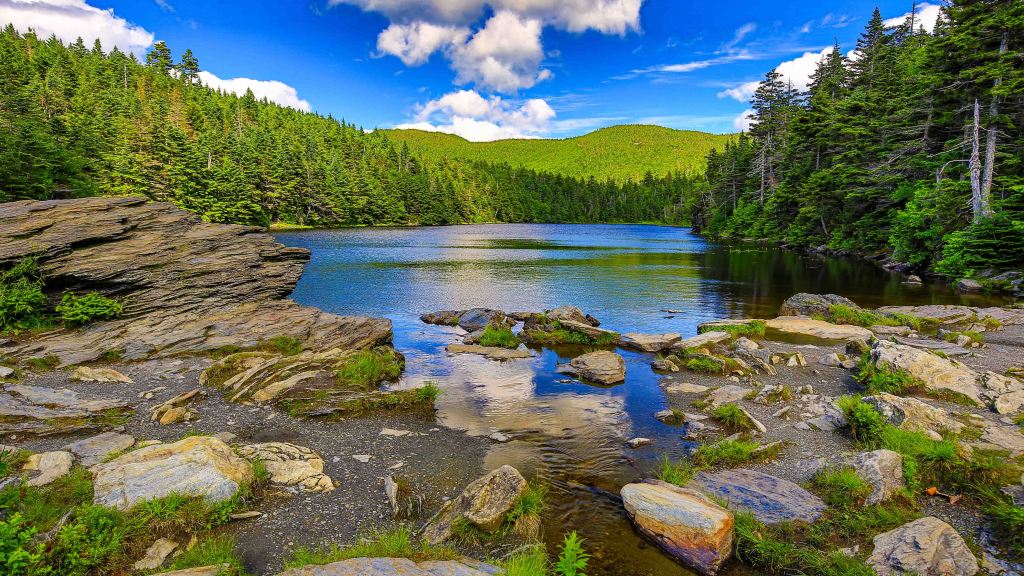
Spruce Peak via Sterling Pond
This 2.8-mile out & back hike to 3,324-foot summit of Spruce Peak starts as a steep uphill for the first third. The groomed path has tall, stone steps making much of the trail. After the first-third or so the trail gets a more gentle grade just above the stairs. The scenery is dense forest, with Vermont’s many species of trees and lush foliage, along with the granite rock formations and trickling streams that are so abundant in these mountains.

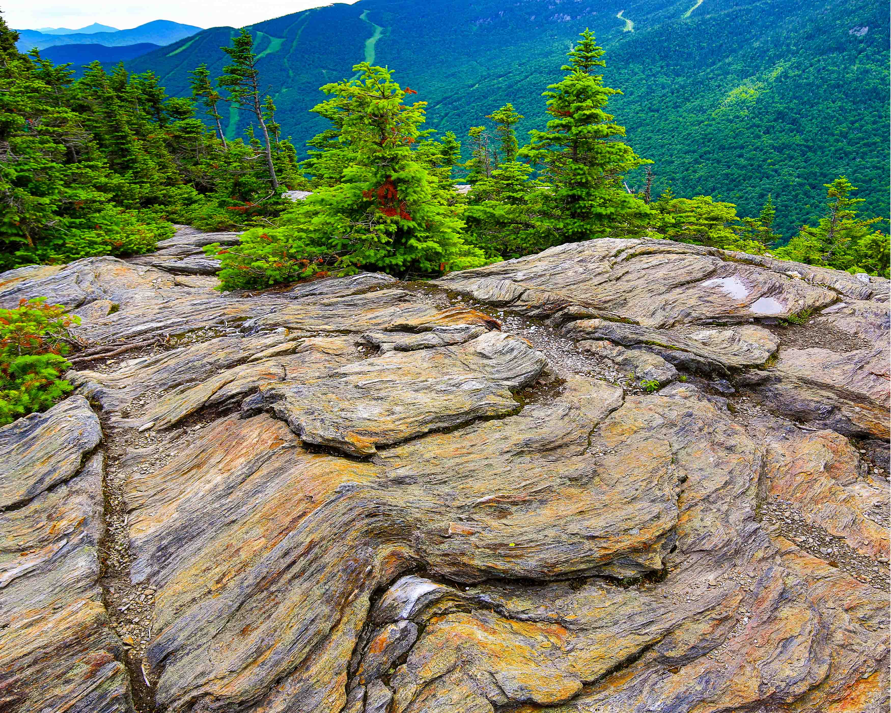
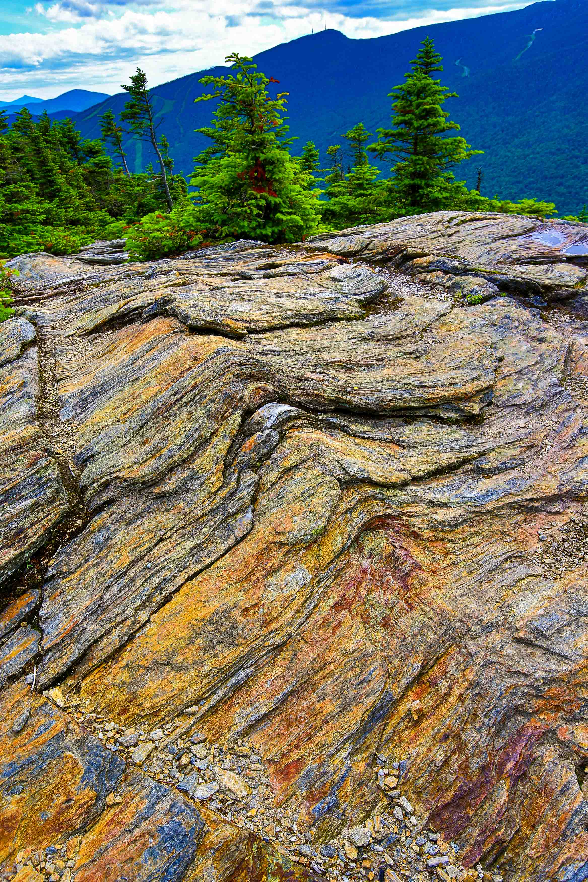
At around 1-mile you reach the side trail to the pond. We continued on to the top of Spruce Peak which we accessed up the ski track to reach the summit at mile 1.4. From there, you’ll get an elevated view over Smugglers Notch and across to Mount Mansfield.
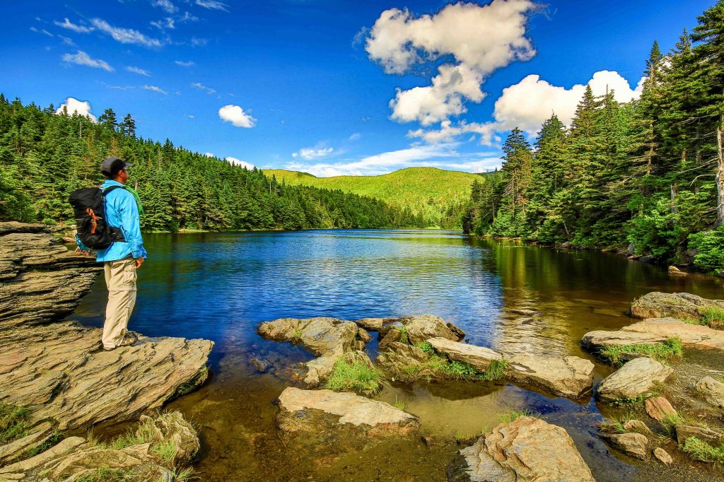
We then followed the trail back down to enjoy some R&R at the pond. This sparkling water lies at the top of the hill, in a natural depression formed by glacial action long ago. It’s a dramatic spectacle–sparkling water lined by deep green conifers. It was a warm day and crowds were beginning to form to dip their toes in the cool waters.
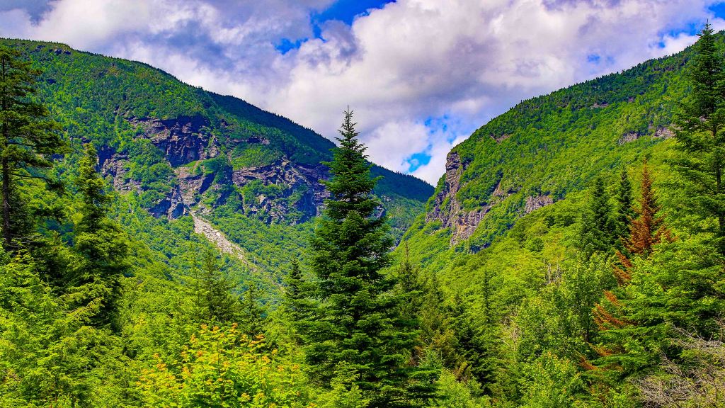
Just a little ways down the road from the Sterling Pond Trail, is a small parking area that has a boardwalk for a view of Smugglers Notch. This is worth a stop if driving by.
Nebraska Notch, Lake Mansfield Trail
Experience this 3.2-mile out-and-back trail just outside Stowe. It is located adjacent to a Trout Club so as you approach via car, there are lots of private property signs. Keep going. You will eventually see a small sign on the right directing you up a steep hill to public parking and the trailhead.
From the trailhead by the Trout Club, the Lake Mansfield Trail enters the woods and parallels the woods road along the north shore of the lake. The trail descends to join the road briefly, before reentering the woods to cross a bridge. The trail descends to the road again near the west end of the lake, and follows the road away from the lake. After crossing a small brook the trail steadily ascends on an old logging road, bears right near the top of the rise and continues uphill at a steeper grade to the entrance of the gorge. Past a piped spring the trail gently climbs to a beaver meadow with views of the north wall of Nebraska Notch. The Lake Mansfield Trail reaches Taylor Lodge and the junction with the Clara Bow Trail 1.6 miles from the summer access trailhead at the Trout Club. At this point, following the AllTrails app, we followed the same trail back to the car.
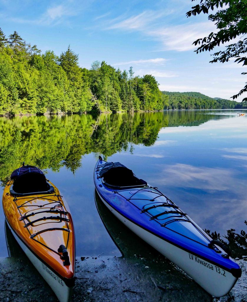
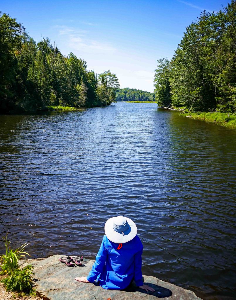
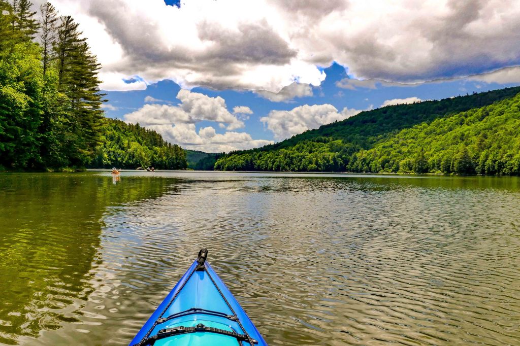
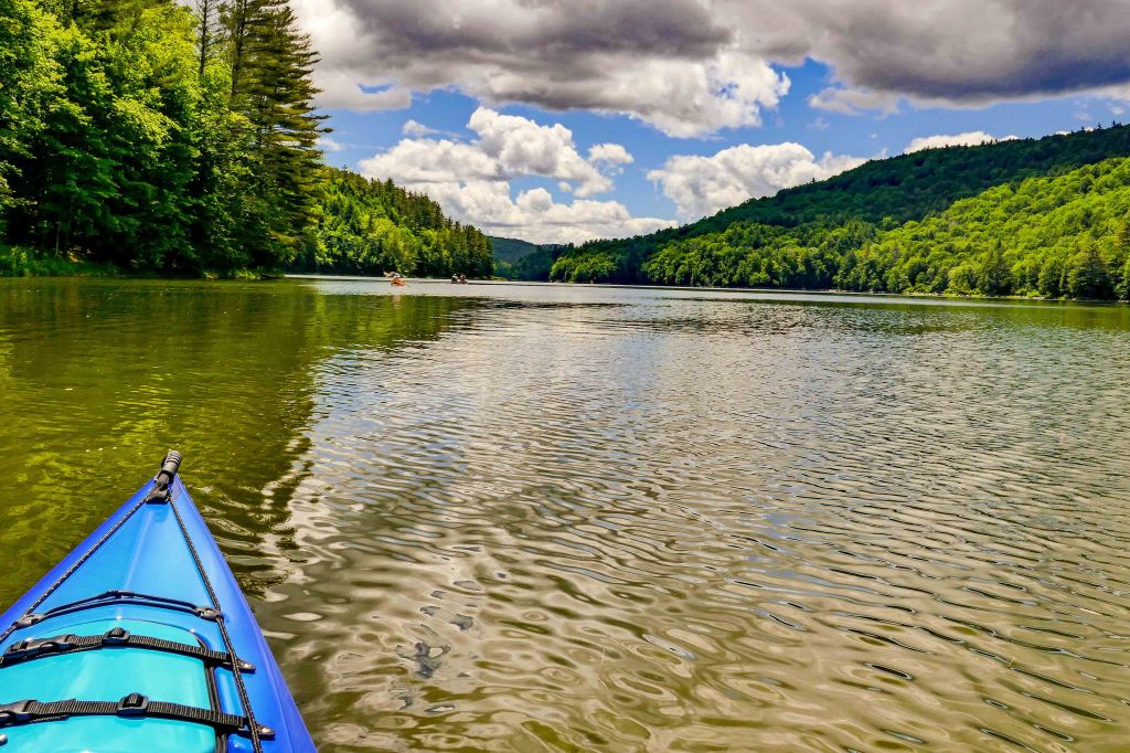
Paddling
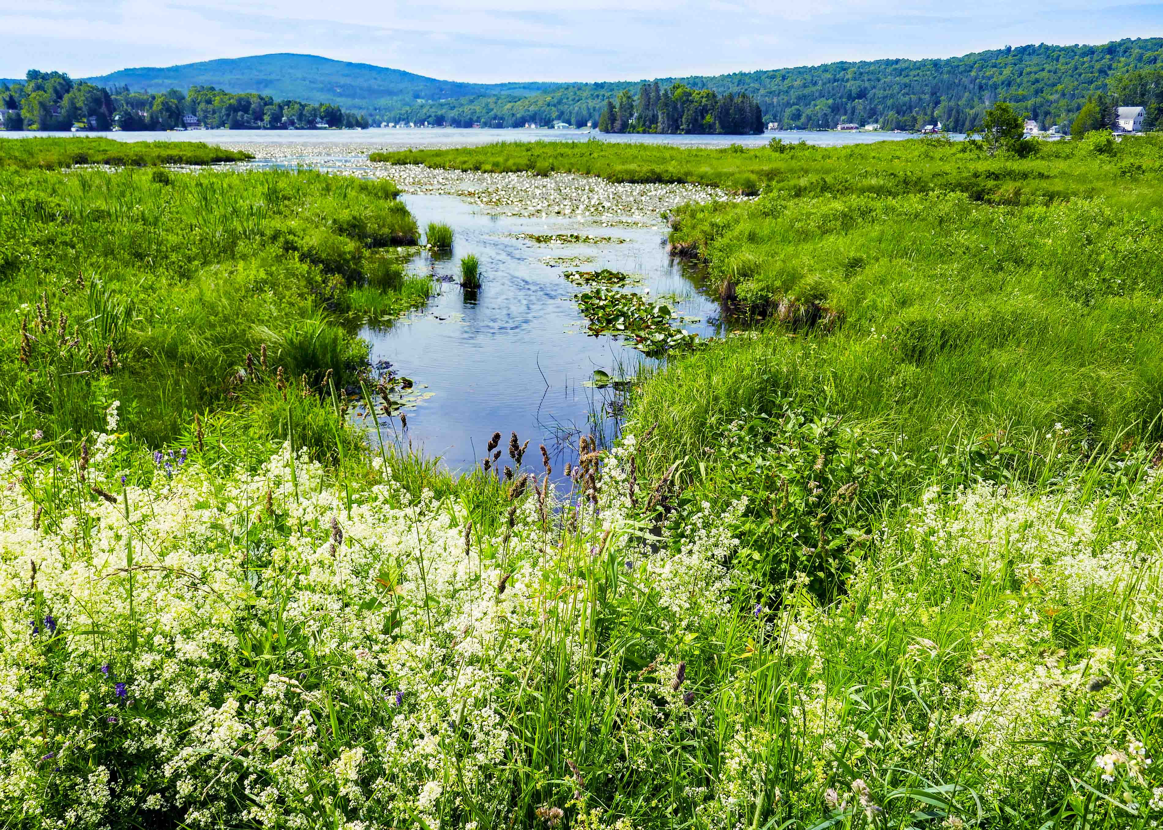
Green River Reservoir

This is not your typical Vermont State Park – Green River Reservoir provides camping and paddling experiences in a remote setting. The state is dedicated to keeping this area in its wild and undeveloped condition, with low-impact, compatible recreational use allowed on and around the Reservoir.
The 653-acre Reservoir includes about 19 miles of shoreline, one of the longest stretches of undeveloped shorelines in Vermont. The Reservoir is designated as a “quiet” lake under Vermont “Use of Public Waters Rules.” Boats powered by electric motors up to 5 mph and human-powered watercraft (canoes, kayaks, etc.) are allowed. There are 27 remote campsites at various locations around the Reservoir. Camping is allowed only at designated campsites and can only be reached by boat.
We had heard the area gets busy and unlike us, we were going on a Sunday. We arrived early and the multiple parking area was full. We just happened upon a spot closest to the launch. We got set up as we put in the water with very little activity except alone swimmer heading to shore.
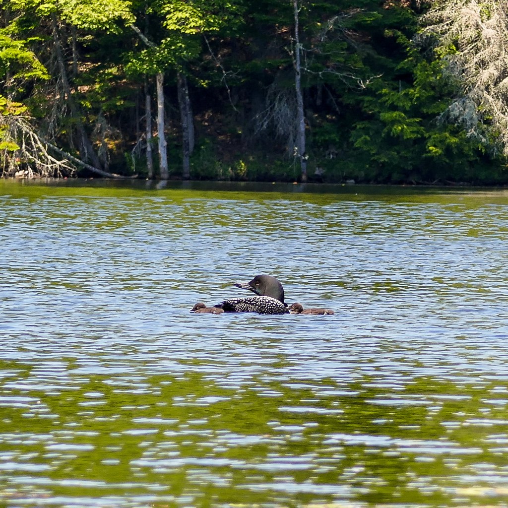
As we paddled, campers were waking up and starting their day. As were the nesting loons! This was our very first BABY LOON sighting.
As we paddled the length of the lake and had done about 8 miles, we found a spot to take a break, eat a snack and reflect on our tranquil and beautiful surroundings.
Things were starting to get busy so we took that as our cue to head out. Ours had been a perfect kind of day. At the launch site, around 1:30 PM, things were nutty! Hordes of paddlers: canoes, kayaks, paddleboards were all jockeying to get in the cool waters.
We highly recommend this paddle. If you prefer more tranquil surroundings, go early on a weekday. If you don’t mind the crowds, anytime would be good for you.
Waterbury Reservoir
The Waterbury Reservoir, created in 1938 by damming the Little River as a measure to prevent future flooding in the Winooski River valley below. A thickly settled area, including general stores, schools, cemeteries, and churches now sleep beneath the 80-100ft average depth of water. Almost entirely surrounded by vast state forests, with some 18 miles of shoreline, the Waterbury Reservoir provides an opportunity for fun and relaxation.
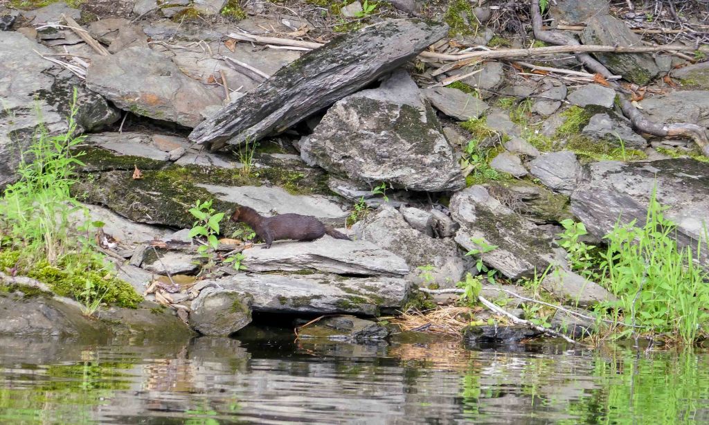
With deep water and mountain views in every direction, the Waterbury Reservoir is a premier destination for water sports, backcountry camping, swimming and wildlife viewing. The only downside for us was that this body of water allows motor boats.
We chose a Tuesday and really didn’t see that many other boaters. I believe there was 1 or 2 motor boats and only a couple other paddlers. We paddled the entire reservoir staying close to the shoreline where we saw a little Mink fishing along the shore. We watched him for some time but our presence didn’t seem to bother him, ar all.
This is another paddle we fully enjoyed and would absolutely repeat if we ever return to the area.
Biking
Stowe Recreation Path
The internationally recognized Stowe Recreation Path (or “rec path”) is a perennial favorite among visitors and local residents. This 5.3-mile paved public path is free to use and easy to access. It starts in the historic Stowe Village and ends at a beautiful covered bridge. People of all ages will enjoy scenic views along the mostly flat and level trail.
Parking for the Rec Path is available at the following locations:
- Lintilhac Park: behind the Stowe Community Church on Main Street in Stowe Village
- Chase Park: across from Stony Brook Condominiums on Luce Hill Road, just off the intersection of Route 108
- Thompson Park: off Route 108 across from Percy Farm Corn Maze
- Topnotch Access: off Brook Road, just past Topnotch Resort on Route 108
Burlington’s Island Line Rail Trail
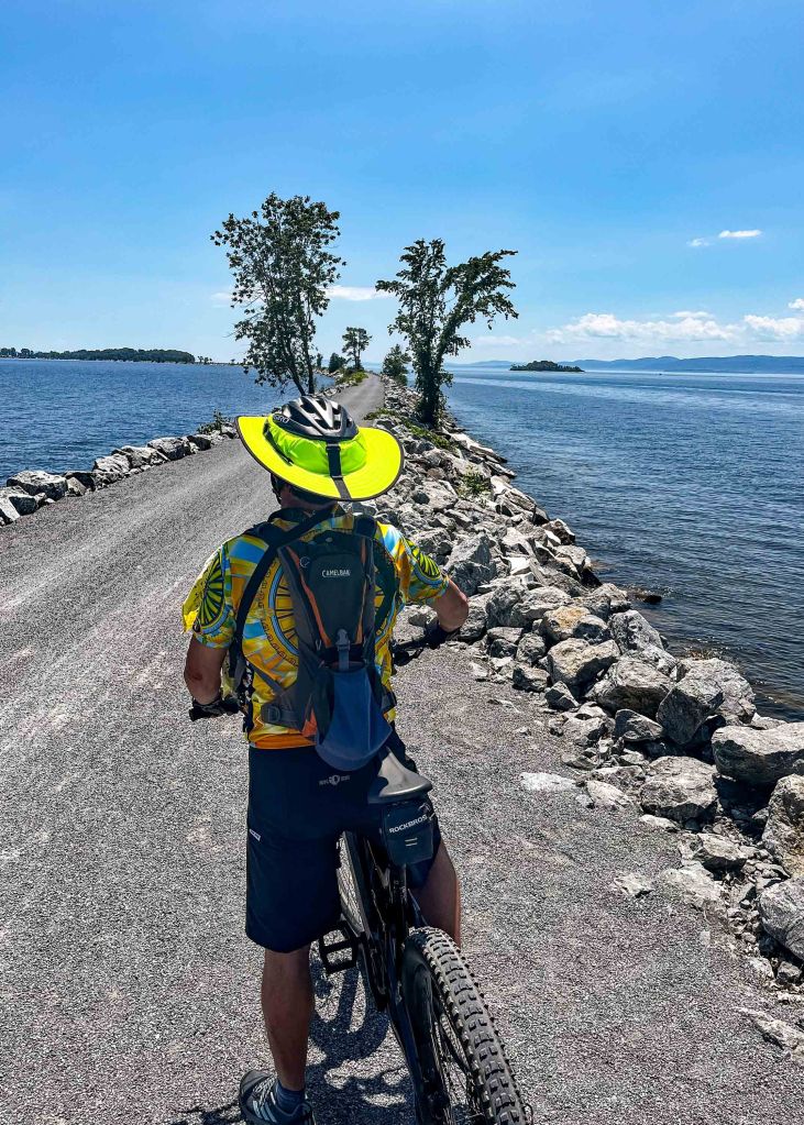


The Rutland-Canadian Railroad built the Island Line in 1899 to connect coastal markets in New England with the Great Lakes, eventually reaching Lake Ontario. As rail transportation fell into decline, the railroad scratched its passenger service in 1955 and freight service in 1961. It wasn’t until the 1980s that the idea of a pedestrian trail took hold; now more than 150,000 visitors use the trail each year.
The Island Line Rail Trail quickly went to the top of our MOST FAVORITE rail trails. Weve ridden numerous ones across the eastern part of the country stretching from Florida to Maine to Arkansas. This jewel offers some of the most spectacular scenery and unique experiences you’ll we’ve encountered. The route follows the Lake Champlain shoreline north from Burlington, Vermont, with beautiful vistas of New York’s Adirondack Mountains off in the distance. The crown jewel of the trail is a 4-mile causeway which gives the sensation of literally biking over Lake Champlain. The route also travels over the Winooski River Bridge, and includes a ride on a unique bike ferry. With a little something for everyone, this trail offers a lot of variety and is perfect for families. Great trails draw great crowds, however, so set out with the appropriate expectations in order to fully enjoy the experience the Island Line Rail Trail (ILRT) has to offer.
The southern 8 miles of trail are paved, and the remainder is hard-packed crushed limestone. All of it makes for a smooth ride and amazing diverse adventure. Just be prepared for crowds. We noticed that those on rental bikes didn’t necessarily have proper trail etiquette but for the most part everyone was courteous.
We parked at Oakledge Park in Burlington. Not knowing any difference, we parked at the metered parking which got quite costly at $2 per hour, In hindsight, we would have parked at the adjoining lot for $10 day. We didn’t notice this spot until much later, our bad.
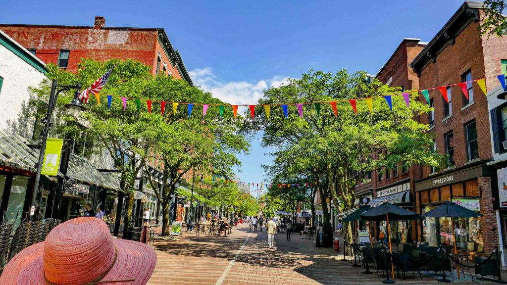
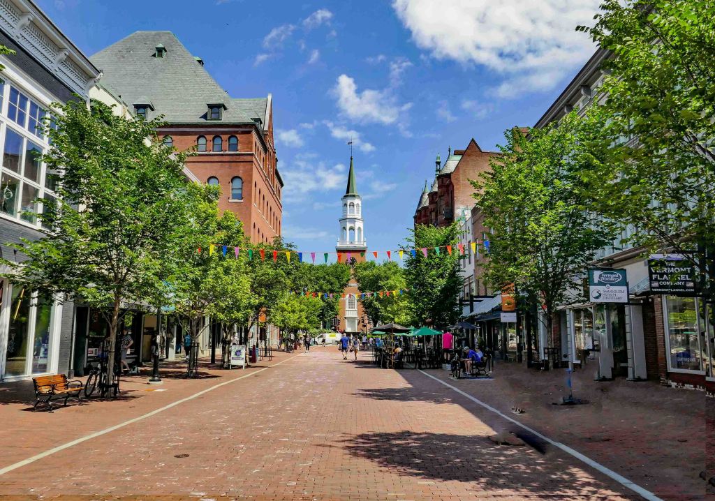
While in Burlington, we stopped and walked around Church Street Market. Very cute shopping and dining area.

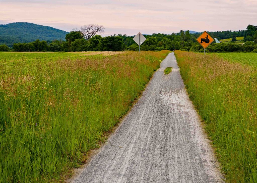
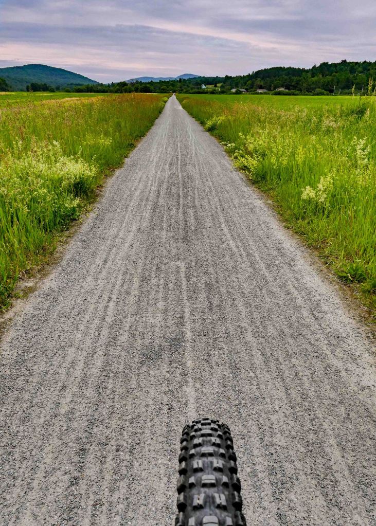
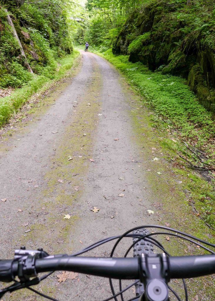
Lamoille Valley Rail Trail
The Lamoille Valley Rail Trail (LVRT) is a growing, year-round trail across northern Vermont that will one day stretch 93 miles between St. Johnsbury and Swanton. The trail passes through the spine of Vermont’s Green Mountain Range, from the Connecticut River to Lake Champlain. When finished, the LVRT, covering five counties and 18 towns, will be one of the longest rail-trails in New England. Our experience was broken up into 2-separate trips with 2 totally different landscapes.
Lamoille Valley Rail Trail – Morrisville to Cambridge

This is a 17.4 mile stretch starting at Morrisville to Cambridge. Miles and miles through farmland and riverside areas with mountain views and (mostly) the sounds (and smells) of nature!
When we reached the most adorable trailhead park at Cambridge Junction complete with a restored train station created into a community playground and marked by one of Vermont’s iconic covered bridges built in 1887.


We then followed Cambridge Greenway a mile or so to a local deli. Grabbed a yummy sandwich and to-die-for maple donut 🍩 to sustain us on the ride back to the car.
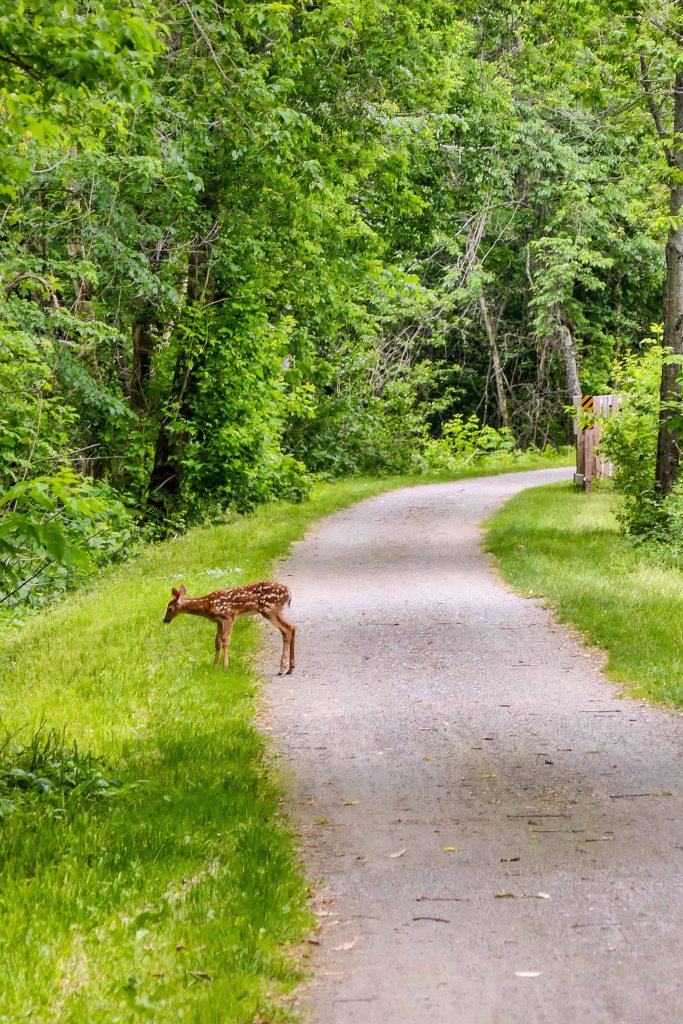
It was a very fun filled day complete with a little fawn that welcomed us on the trail.

Lamoille Valley Rail Trail – West Danville to St. Johnsbury
We started/parked at Joe’s Pond Beach in West Dansville. We rode the first 2-miles of the trail winding along the shoreline of Joe’s Pond giving way to wonderful water views.
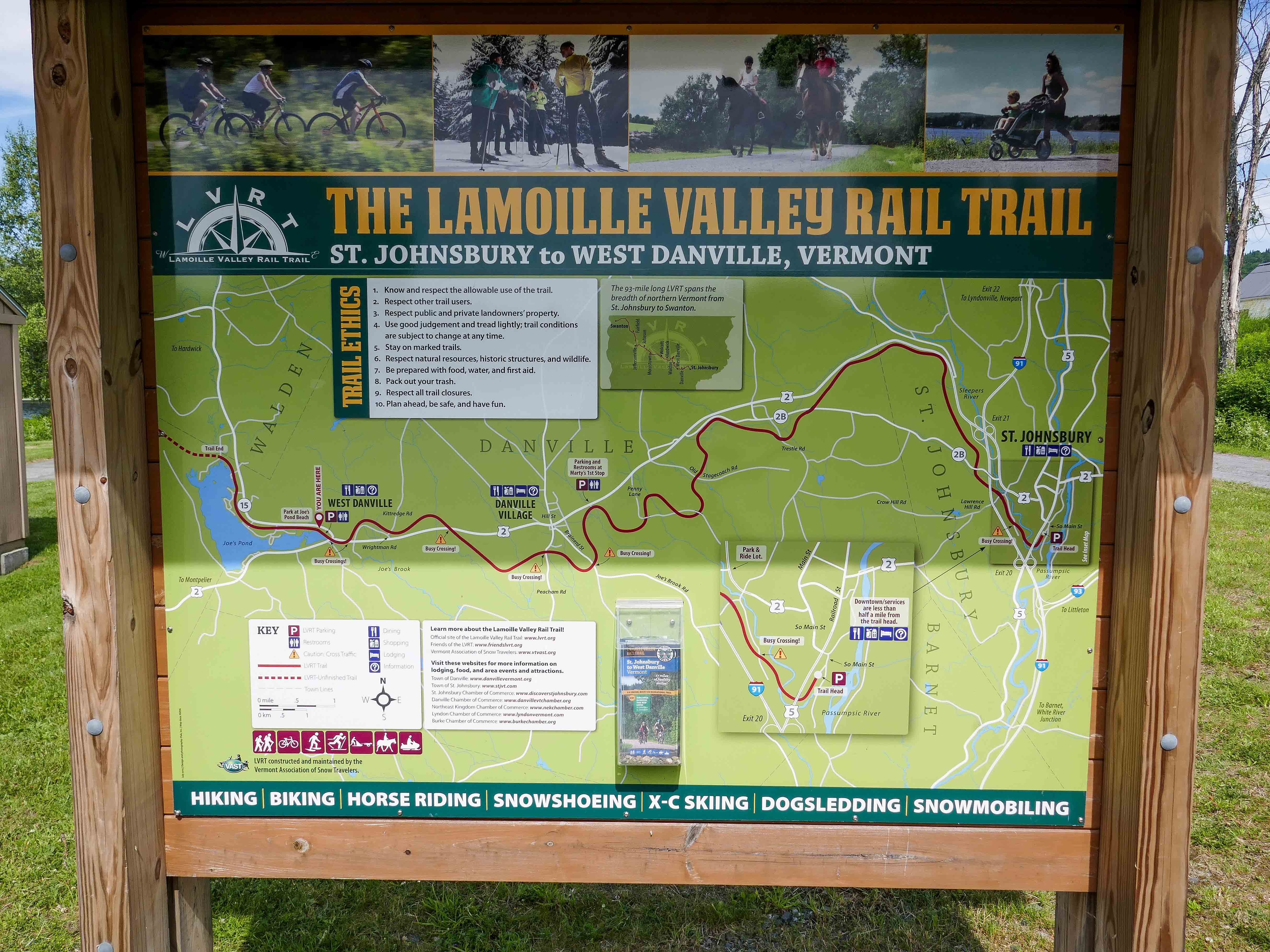

We then rode back, crossed the busy road segments of Route 2 to start the 15-mile segment through trails lined by steep and interesting rock cuts created long ago to allow train passage through the area……and other wide open sections crossing through open fields with glorious mountain views. Enjoying the beautiful Vermont scenery all the while peddling along.

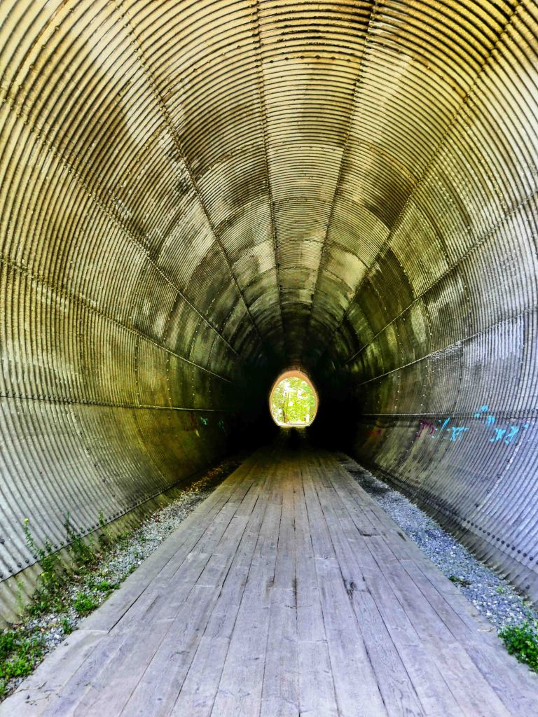
As we neared St Johnsbury we passed through a couple of very cool old train tunnels.
We rode into the cute town of St Johnsbury to grab a bite to eat at a local deli and then hit a creamery for a cool treat on a hot day.
We finished this fine day with a maple creamee at a roadside market.

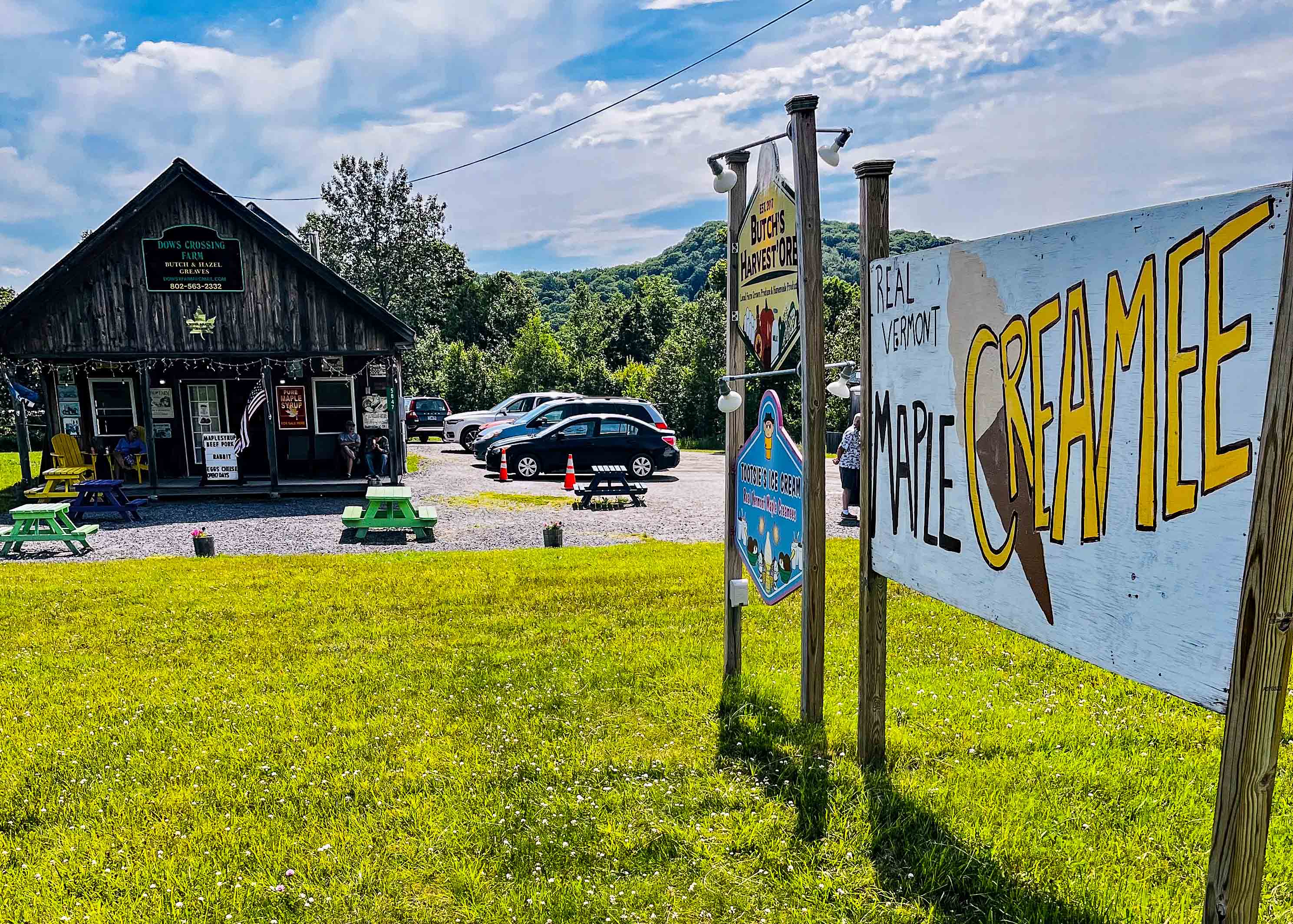
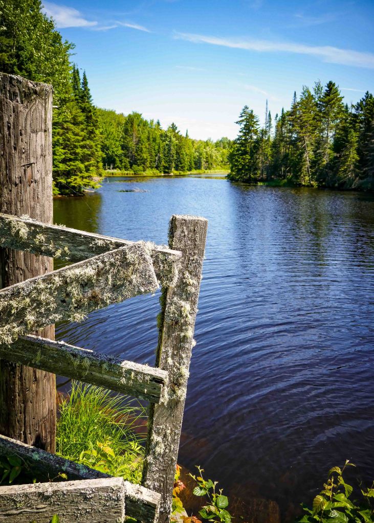
Extra Pictures
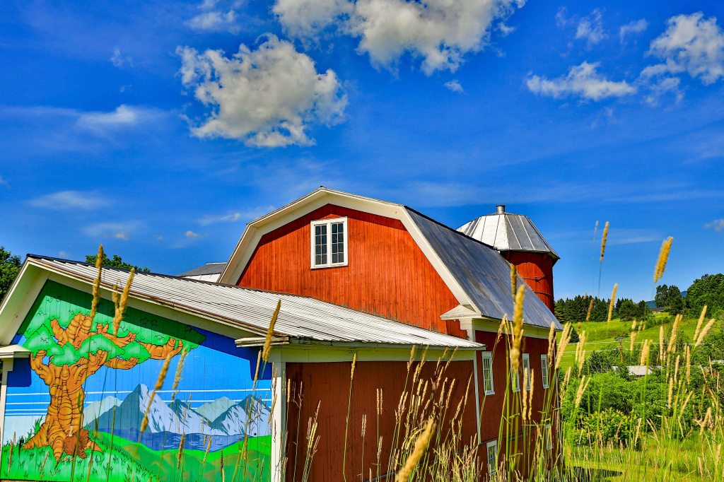
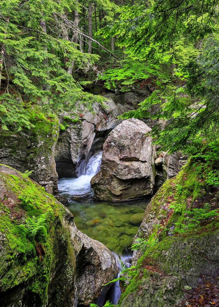
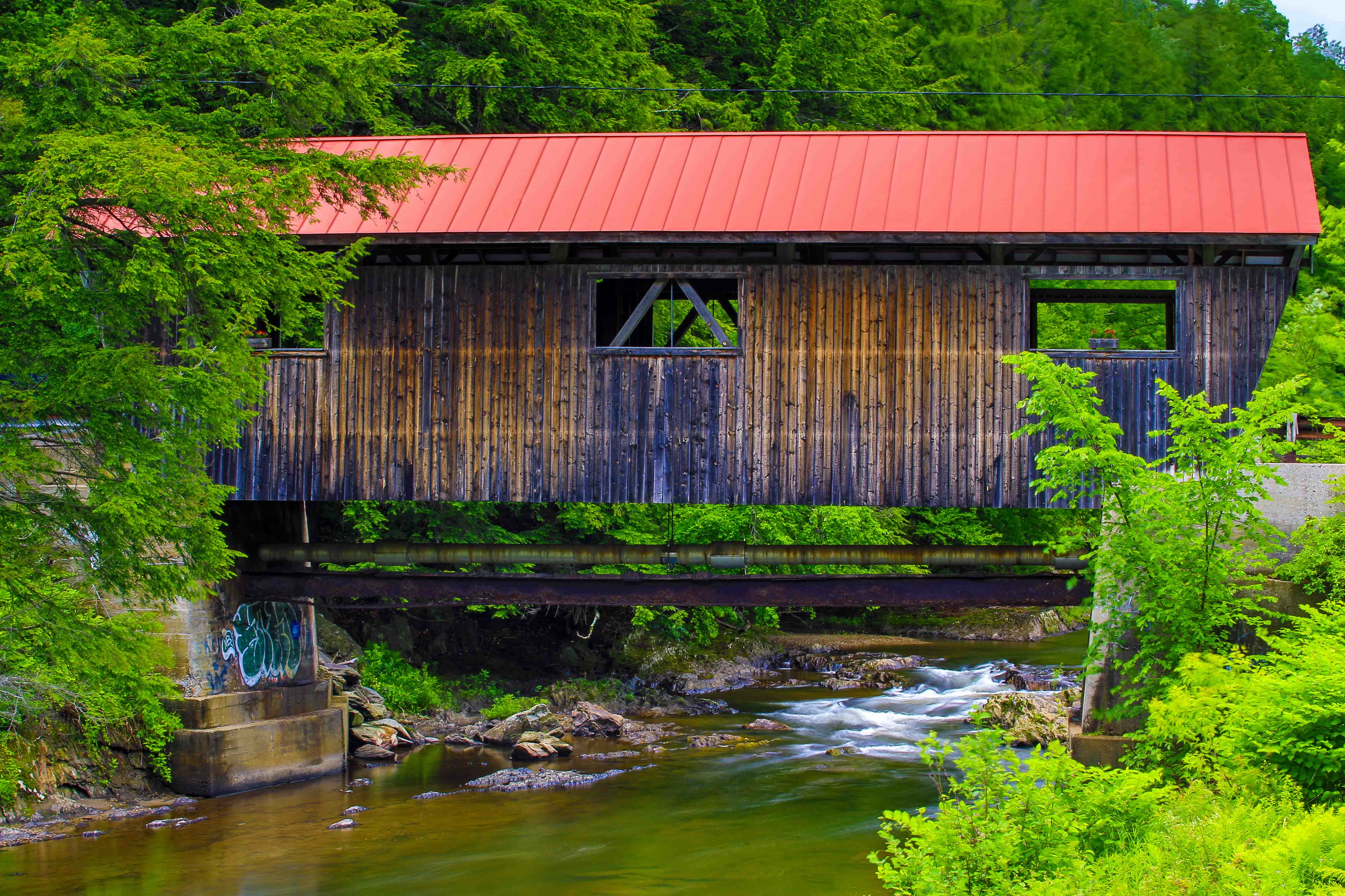
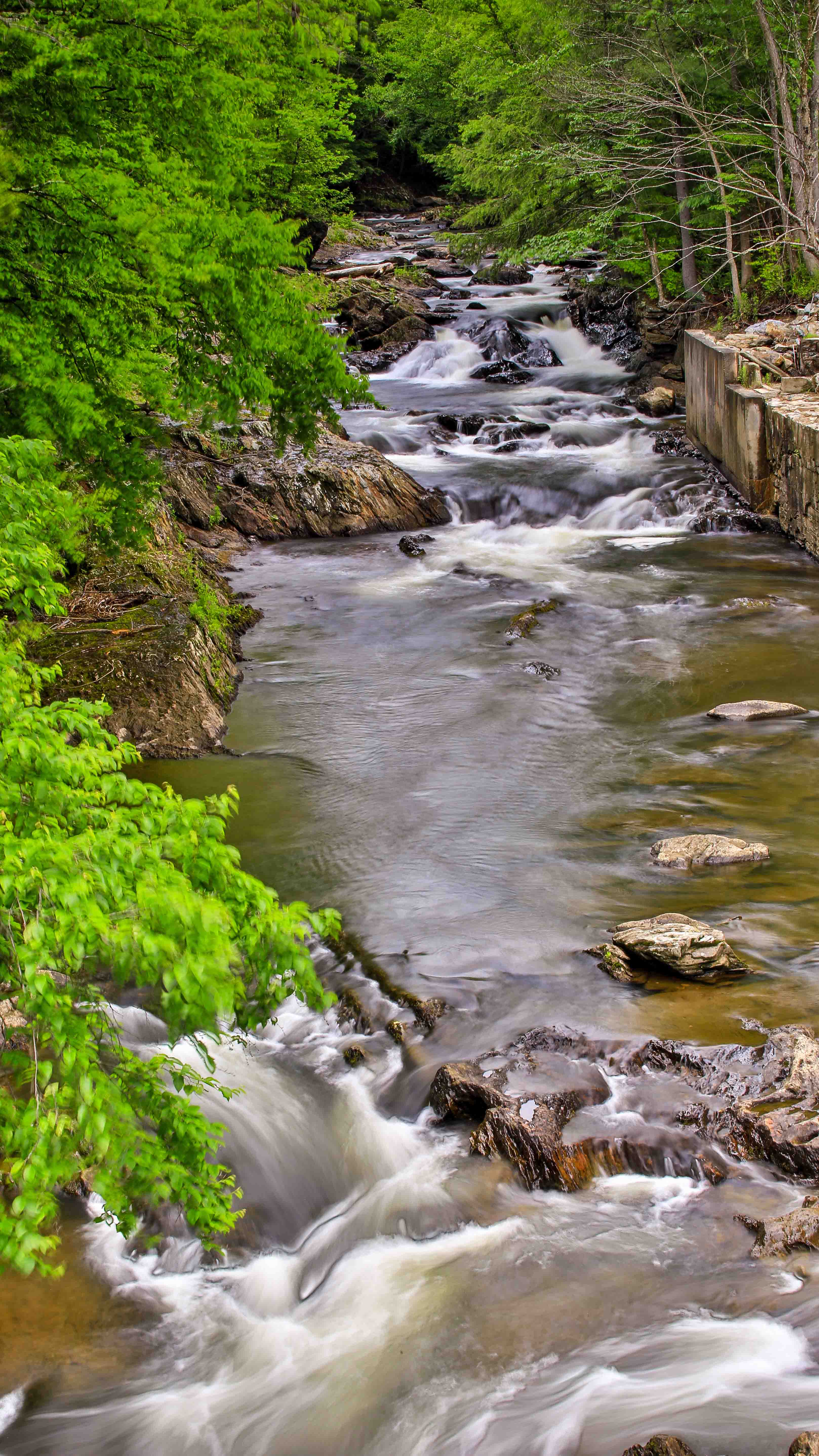
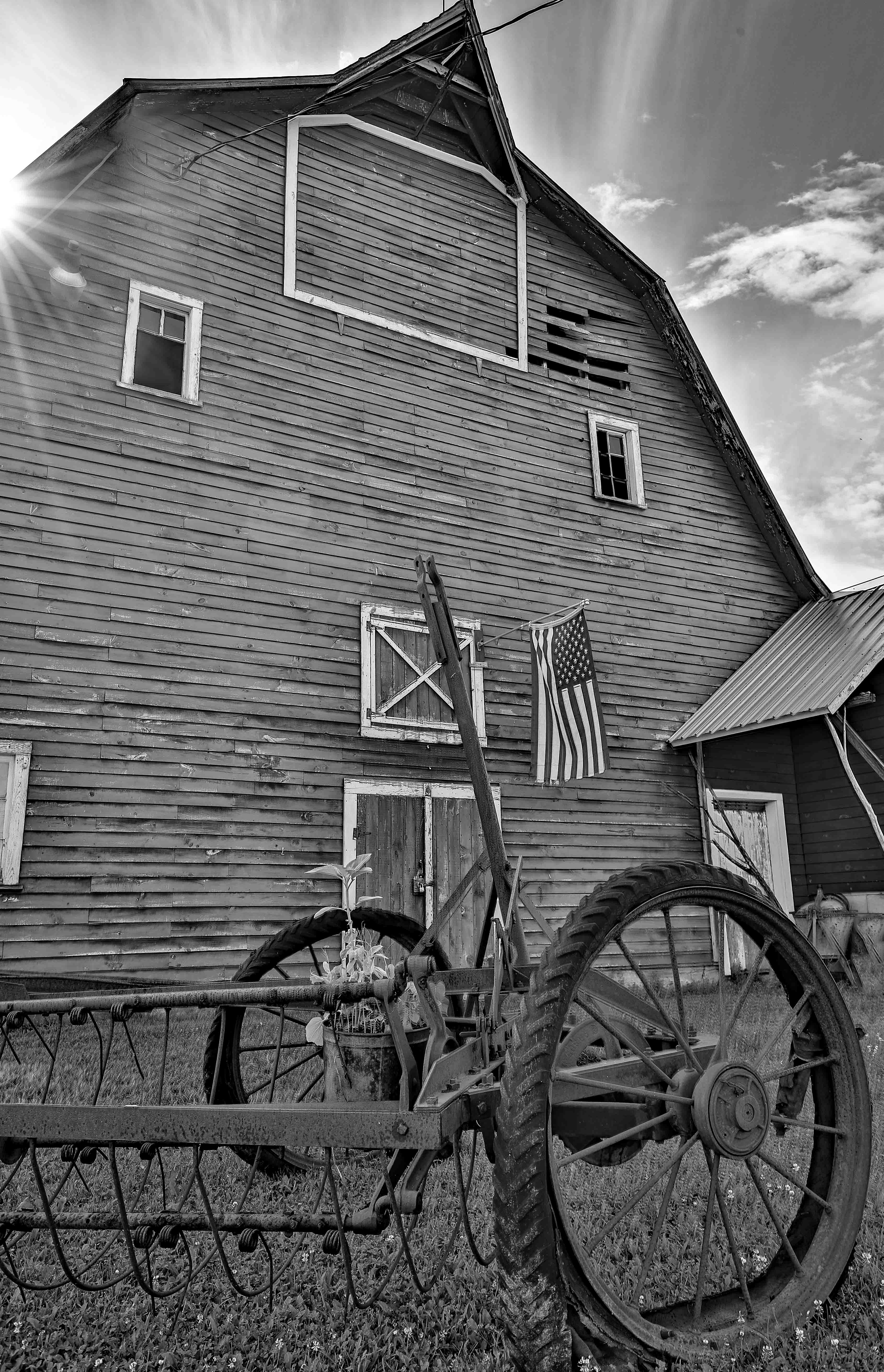
The following are a few extra photographs from the area. Bingham Falls is a very short hike just outside of Stowe. Powerhouse Covered Bridge is just down the road from the town of Johnson. The barn, well they are everywhere.


What’s Next?
That concluded our stay in this section of Vermont. In our next post, while in New Hampshire’s White Mountain region, things go a little sideways for us and we will end up back in Central Vermont with more adventures to report around Woodstock, VT.
Follow us along at:
Instagram: @nspiredadventuresblog
Facebook: Nspired Adventures (Page)
Fine Art America: Nspired Eye Photography
RV Life Campground Reviews: https://campgrounds.rvlife.com/profile/212086
Email: nspiredadventures2020@gmail.com
