

North Side of the White Mountains
Because of the Medical Emergency and our unexpected stay in Woodstock, Vermont so that I could be near Dartmouth Hitchcock Hospital and my hand surgeon, we arrived in Twin Mountain, NH on August 14th for an 8-night stay on the North side of White Mountains.
The very gracious folks at Twin Mountain Motor Court and RV Park were able to accommodate out last minute changes with a lovely spot in their quaint 18-Site RV Park. The location was perfect for such activities as The Mount Washington Cog Railway, beautiful driving scenery and a few gentle hikes as I was extremally limited for any of our originally planned hikes. Mike took the opportunity to “explore more” which we will detail later in this post.
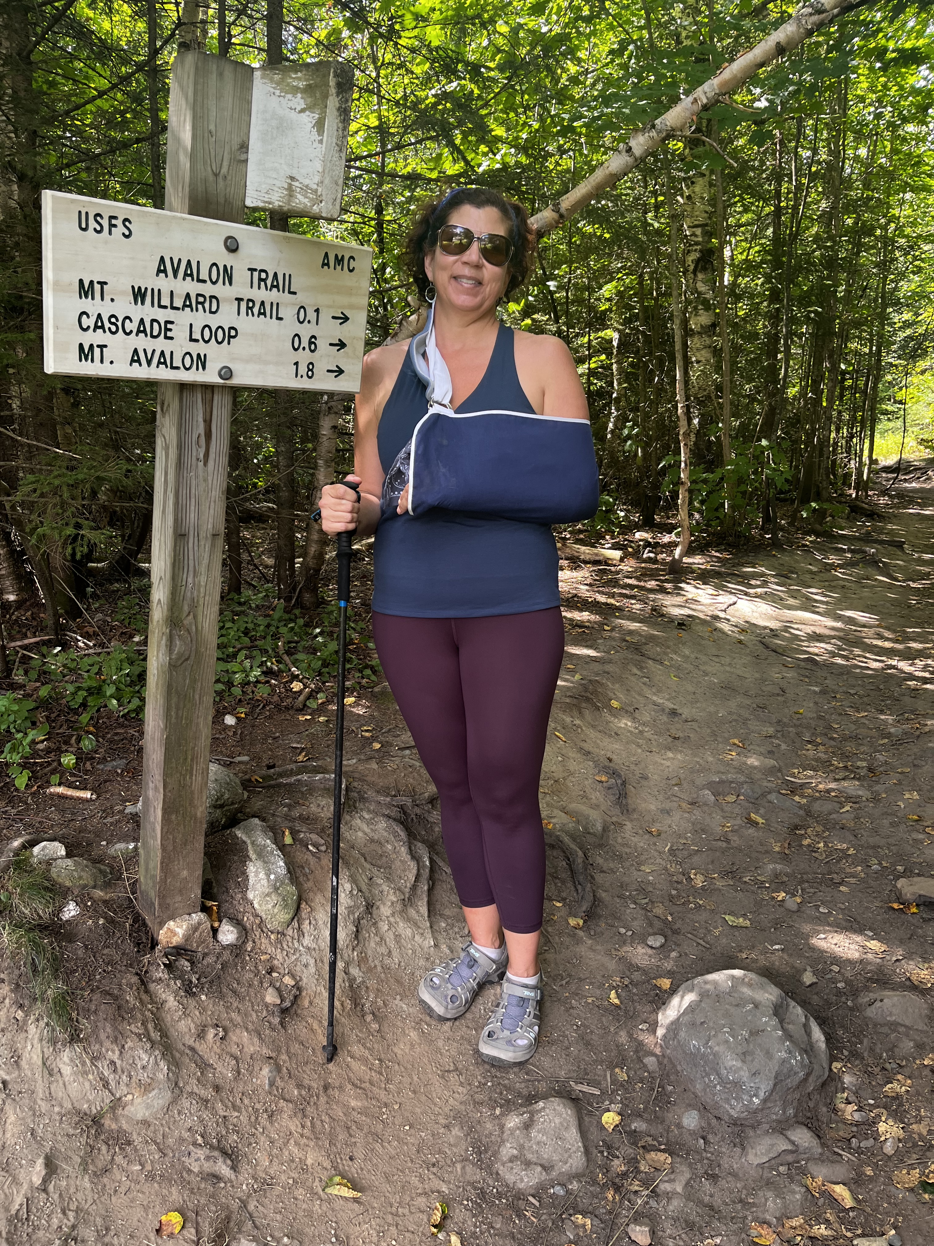
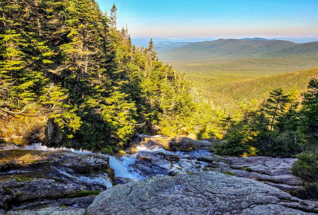
Mount Willard Trail
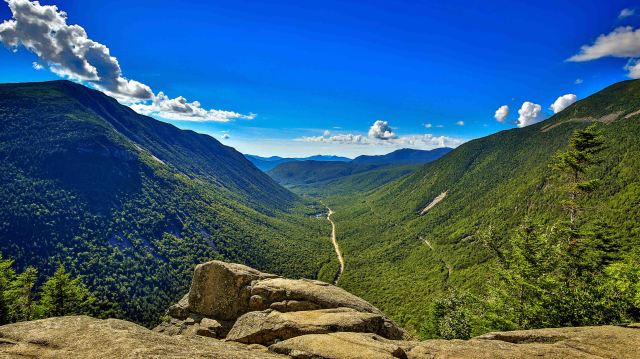
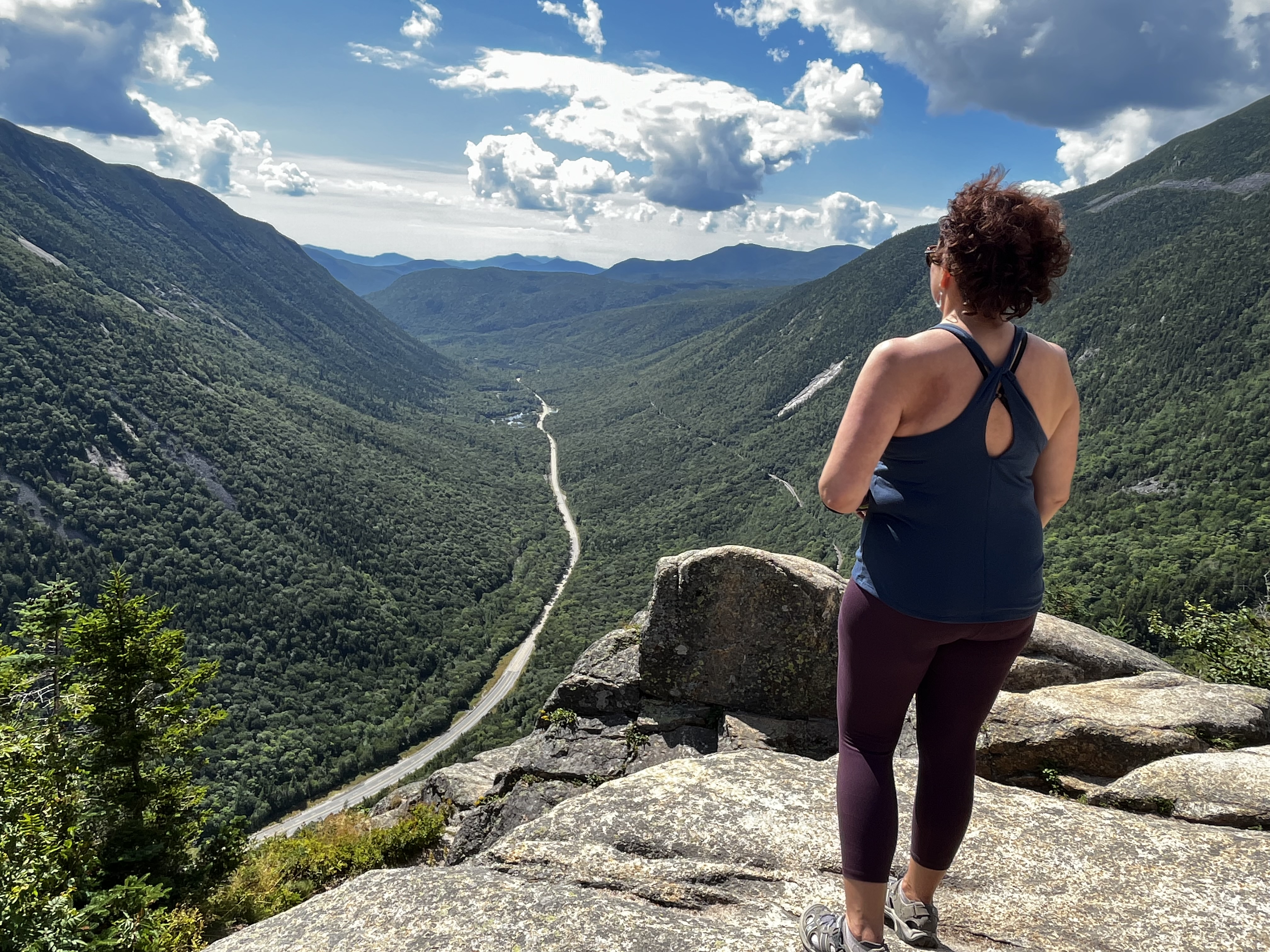
Mount Willard, a 3.2-mile out-and-back hike is one of the most rewarding short and easy hikes in New Hampshire. With only a gradual 895-foot / 1.6-mile climb to the cliff view of Crawford Notch, it is a prime destination for inexperienced, new, or even seasoned hikers.
This was my first “real” hike since my biking accident had me in a cast. It was a beautiful summer day in the White Mountains for a hike. I remember it being a nice temp and we didn’t encounter too many other hikers and those we did meet were very pleasant.
The top looking down at Crawford Notch offered a spectacular view, don’t you think?
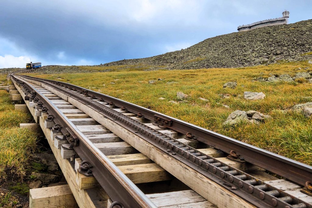
The Mount Washington Cog Railway
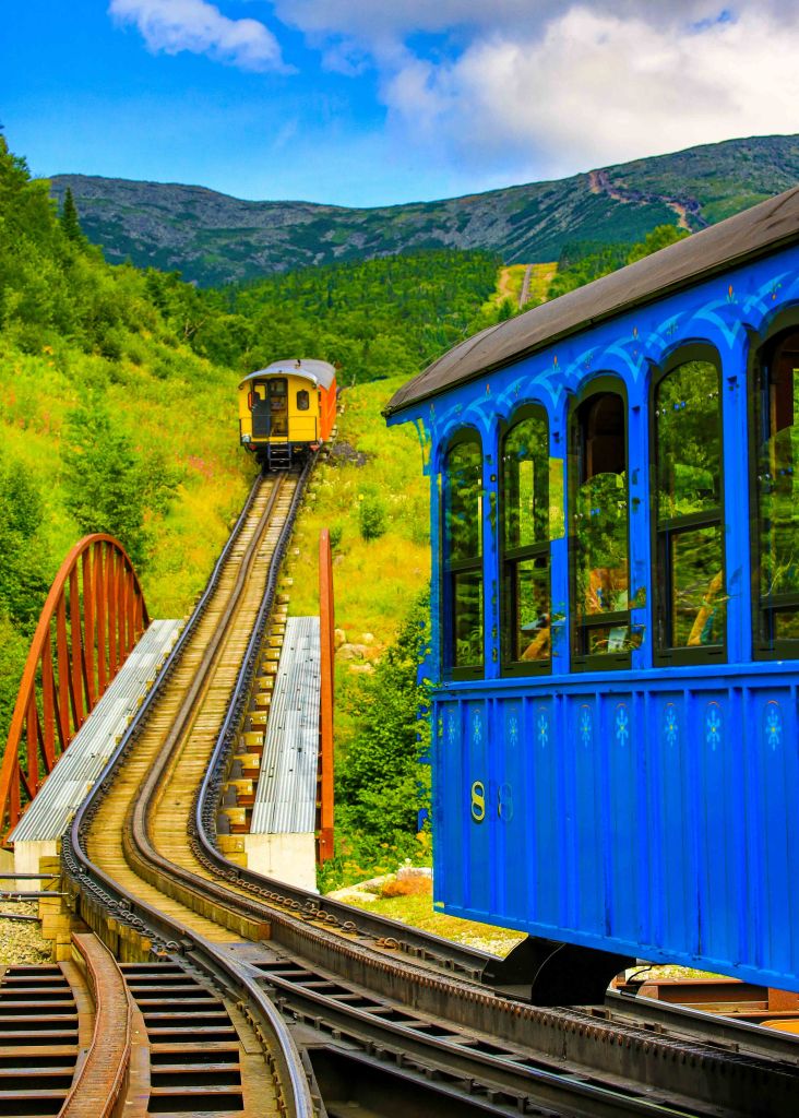
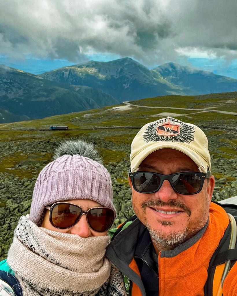
There are several ways to get to the top of Mount Washington, the highest peak in the Northeastern United States at 6,288.2-feet and the most topographically prominent mountain east of the Mississippi River and notorious for its erratic weather. You can: Hike, Drive or take The Cog.
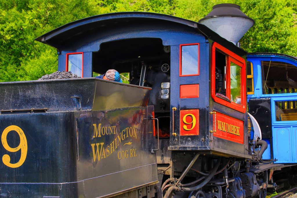
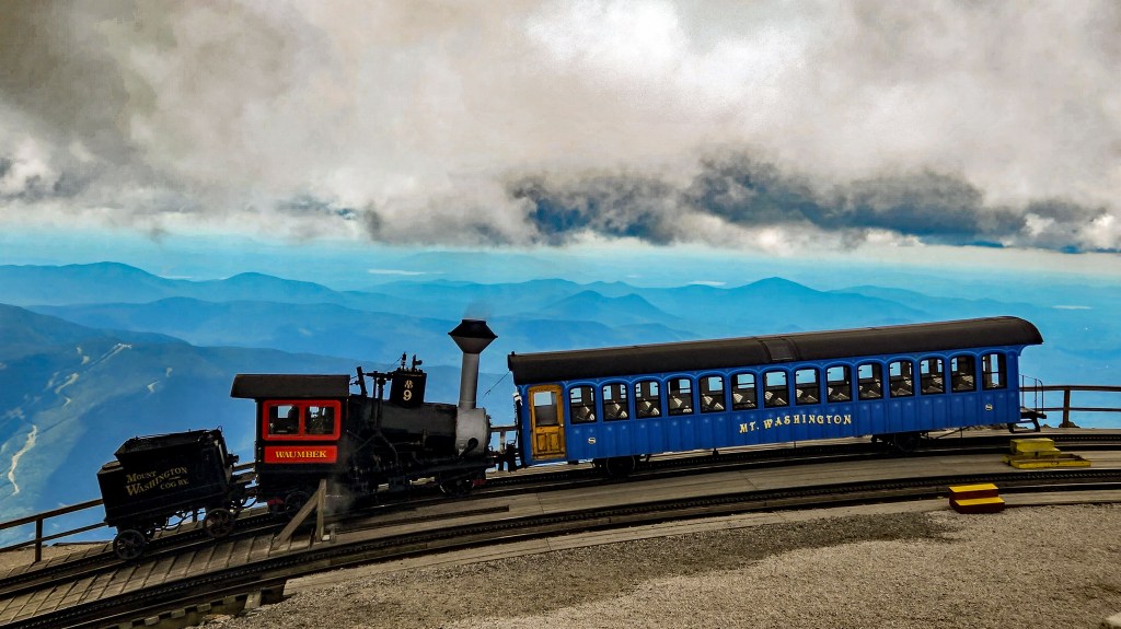
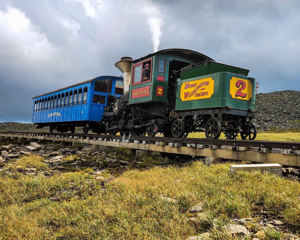
Because of conversations with several other couples who said the drive up is “hairy” and the coasting down is “nerve racking”, we chose The Mount Washington Cog Railway, also known as the Cog. It’s the world’s first mountain-climbing cog railway (rack-and-pinion railway). In either a steam or biodiesel-powered locomotive, you can comfortably climb the (appx) 3-miles/3,600-feet to the top.
We booked the first steam powered locomotive of the day hoping to beat the clouds and winds that usually develop later in the day. The climb up was a treat with entertaining dialogue by our captain and marvelous views.
Once we reached the top we were allowed 45-minutes to marvel at the view,
take our pic at the Elevation Sign and explore the gift shop.
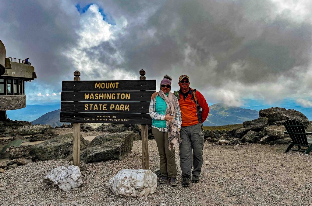
Boy, did that 45-minutes speed by! Especially because we had about 15-minutes before the clouds came rolling in blocking all views and along with the clouds came the high winds and very chilly temps.
Luckily we were prepared with lots of layers that helped to ward off the chill as we walked the area looking for picture opportunities. Before we knew it, the Conductor was ringing the bell for us to get back to the train.
Mount Washington – Mike’s Epic Hike
The Cog adventure inspired me to do one of the epic White Mountain hikes to the top of Mount Washington…and beyond! It was a beautifully clear August day, temps in the 70’s with a gentle breeze. I left the RV before first light with a “pep in my step” excited for this adventure. Knowing that there are many, many rescues by the SAR teams, I was prepared with lots of water in his camelback (along with a hand-held purifier if needed), plenty of snacks, wide brim hat, sunscreen, extra socks and layers should the weather turn (remember, the weather is known to be erratic), and several other necessities to be prepared on the trail. I knew I wouldn’t be isolated or alone as this is one of the most hiked trails in the New Hampshire and it was a weekend in the summer so I felt secure that all would go well as long as I stayed hydrated and fueled.
My route was a 9.3 mile loop with an elevation gain of 4,235-feet which took a total of 11 hours.
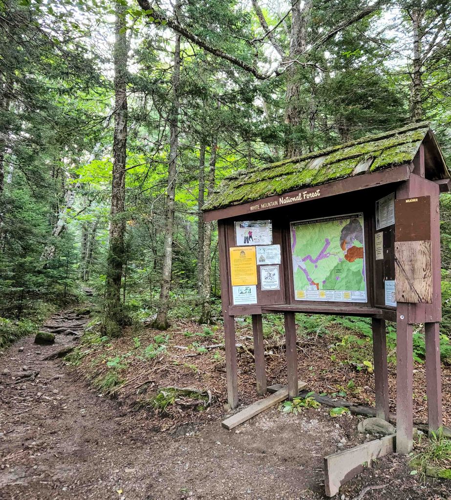
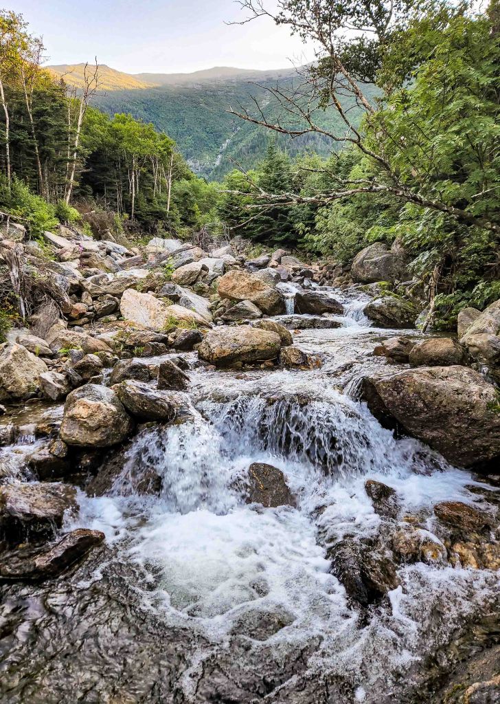
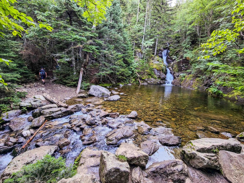
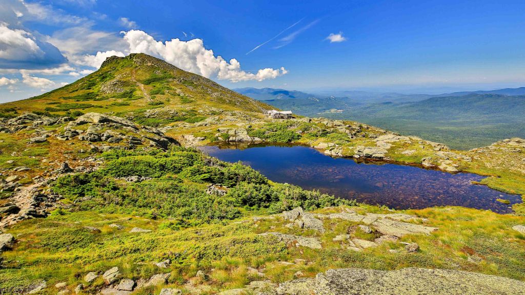
So at 0700 equipped with the AllTrails route downloaded on my phone, my feet hit the Ammonoosuc Ravine Trail. After one last check of the map on the trailhead bulletin board, I started hiking up, up and up. The first thing you notice is the amount of water along the trail. Then the waterfalls that you cross. Then all of a sudden, you are above tree line and the first views of Mount Washington come into the scene. It is still a long ways up. Then you see the Lakes in the Clouds Hut, one of the Appalachian Mountain Club facilities for hikers to stay and eat.
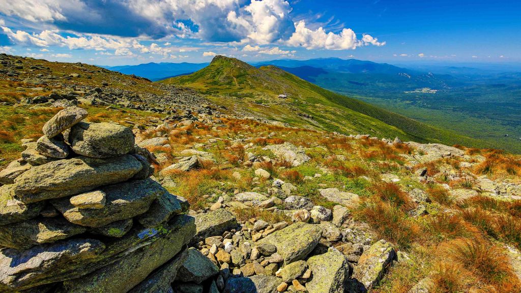
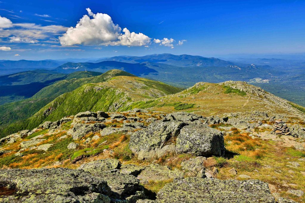
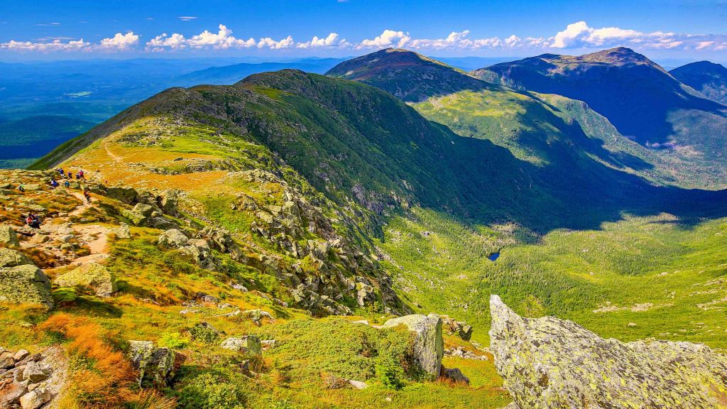
Since the day was so nice, I decided to hike up to Mount Madison before going to Mount Washington. It is only .4-miles to the top and then .4-miles back down. If you look closely, you can see the Appalachian Trail as it comes across the mountains ridgeline. Looking back towards Mount Washington which is where I am going next. I have 1.8 miles to hike in order to make it to the top of Mount Washington. The day was getting hotter and the last half mile up was slow, but I finally got there.
Once at the top, the crazy begins. People are everywhere walking because they arrived by car, train and by foot. There is a large observation deck and a line of people waiting to get there photo taken at the Mount Washington sign located at the very top. I went into the visitor center where there is a gift shop and a food deli. I eat a chili dog, apple and downed a Powerade. Time to head down using the northern side of the mountain so I can reach the Jewel Trail.
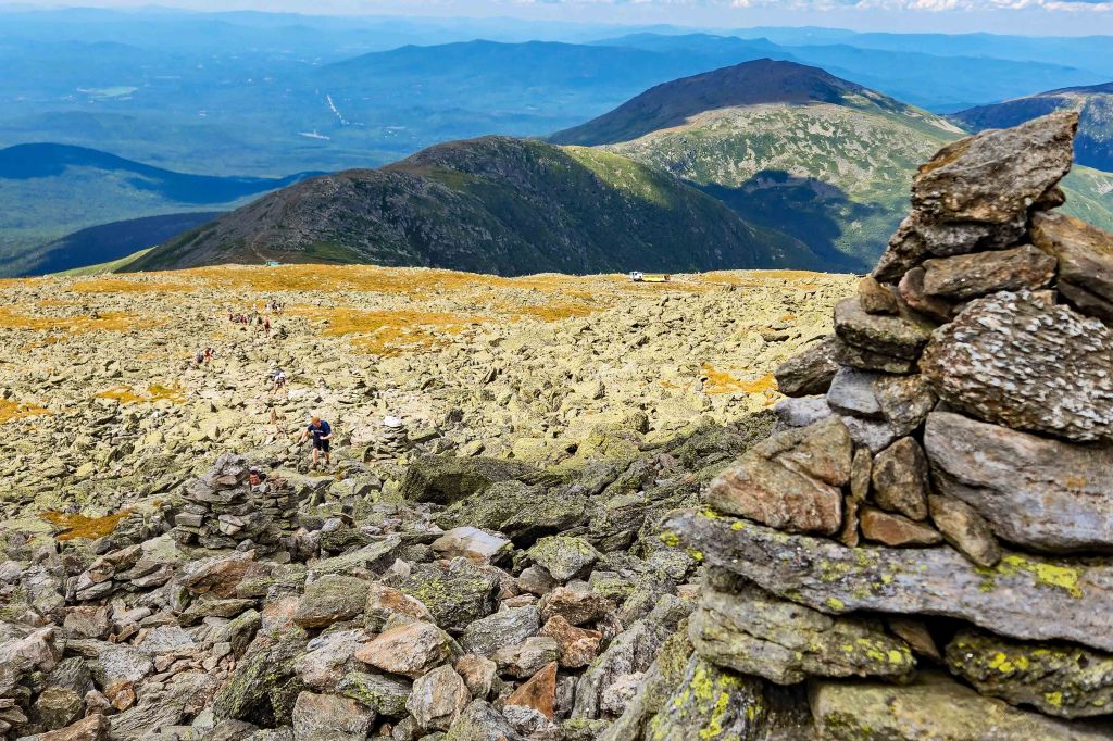
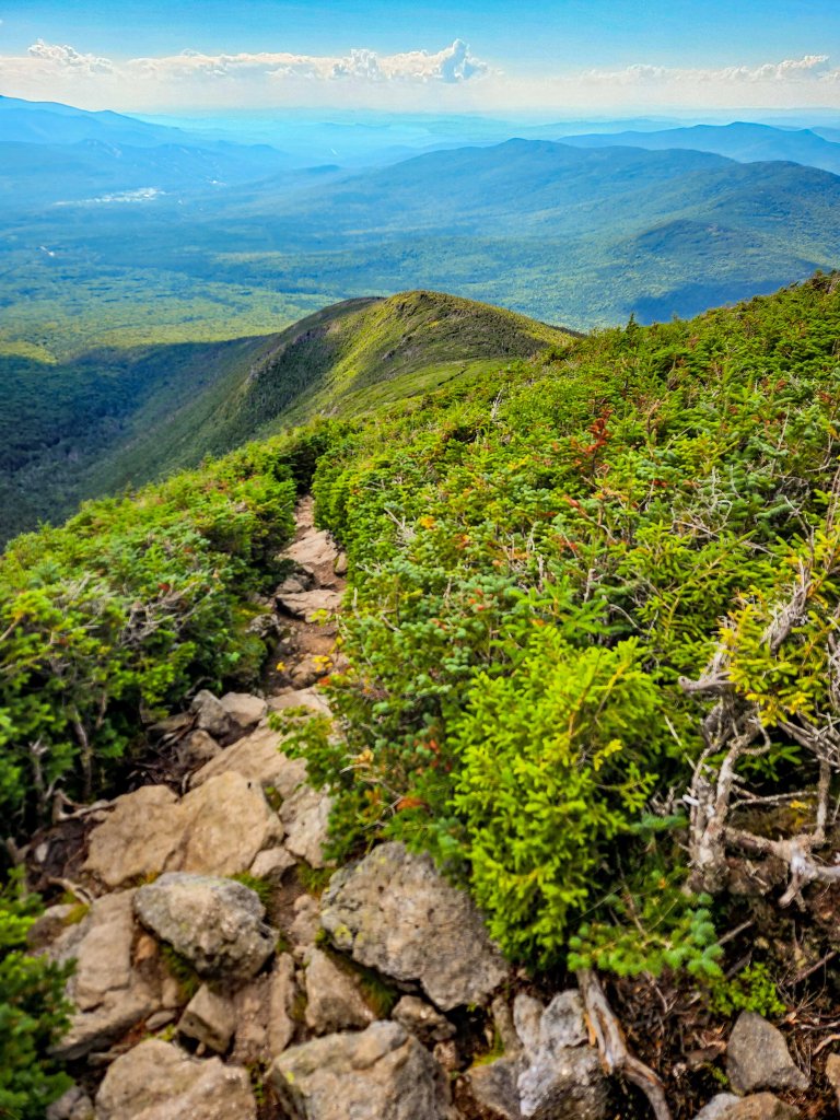
Take a close look at the above photo. You will notice a few things. One, the trail and the mountain is nothing but rock. Large rock, small rock, round and pointy rock. This is what you walk on. There is no dirt. Every step must be carefully placed so you do not trip or stumble. Also look down the trail and you will see a train of people hiking either up or down the mountain. Many of them completely exhausted after hiking the long trail up to the top. Last you may notice how green the rocks are. They are covered with lichen and they are very green.
In the photos below is the cog railway with the steam engine coming down the track taking passengers back down the mountain. They also have biodiesel trains, which is what they use the most of the time.
The view looking out over the presidential mountain range was awesome. The field grass was turning red due to the colder temperature but there was still plenty of green. The mountains off in the distance are Mount Clay, Jefferson, Adams and Madison.
The last photo is the Jewel Trail and I am looking down at the long, long, long way that I have to go in order to get to my car. If you look closer at the far left side of the photo, is a white spec where I started this journey. This was by far the most grueling and painful part of the hike.
Overall I was glad I did it. The sense of accomplishment, the views like no other, the feeling of exhaustion yet exhilaration. If any of you ever decide to do this in the future, my one advice is, take the train back down.
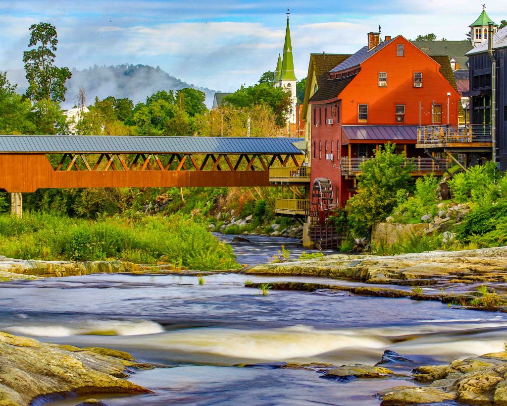
Littleton, New Hampshire
We had an opportunity to get together with our dear friends, Laura and Everett, by meeting at a half-way point in the lovely town of Littleton, named as one of the quintessential small towns in New England. A quick visit will show you why this is such a jewel nestled in the heart of the White Mountains.
We choose Shillings, for some world class lagers and specialty wood-fired pizza deliciously handcrafted by their culinary team. One word: YUMMY!
Not only is Littleton photogenic sitting along the Ammonoosuc River, this delightfully friendly town is walkable, offers a variety of hiking trails and drive up scenic vistas.
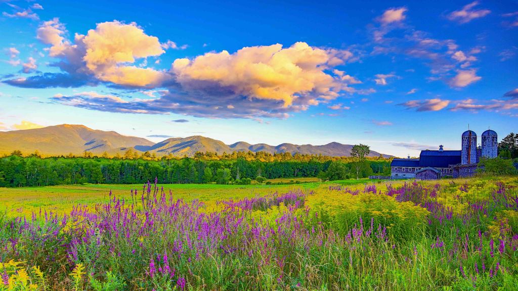
Sugar Hill, New Hampshire
Sugar Hill is a picturesque town that overlooks the White Mountain National Forest, with views of the Presidential, Franconia, Kinsman and Dalton mountain ranges.
We were told two very important facts about this town of approximately 700 residents:
(1) Magnificent photographic views of the White Mountains
(2) Polly’s Pancake Parlor for the BEST breakfast around. Be sure to get there early (we arrived 30 minutes after opening and barely got a table without a wait) to enjoy the famous gourmet pancakes with a view.
Waterfalls
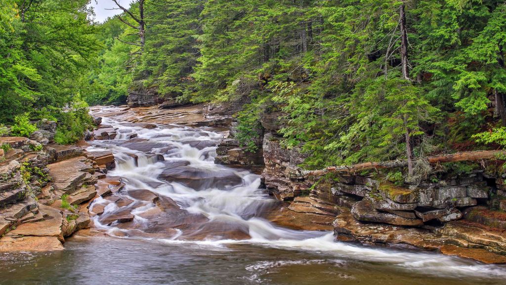
Upper Ammonoosuc Falls
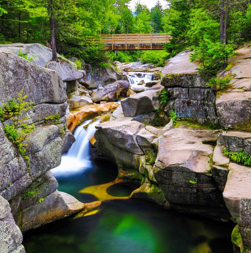
A popular spot for waterfall junkie, photographers and swimmers alike. The highlight is the pools and the gorge, not the fall themselves. This can be tough to photograph since the sun shines directly on it for most of the day. I went back several times and found a rainy day to be my best option as there wasn’t sun to distort my lens and there were fewer people to clog my lens.
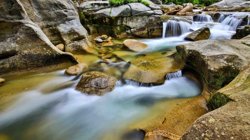
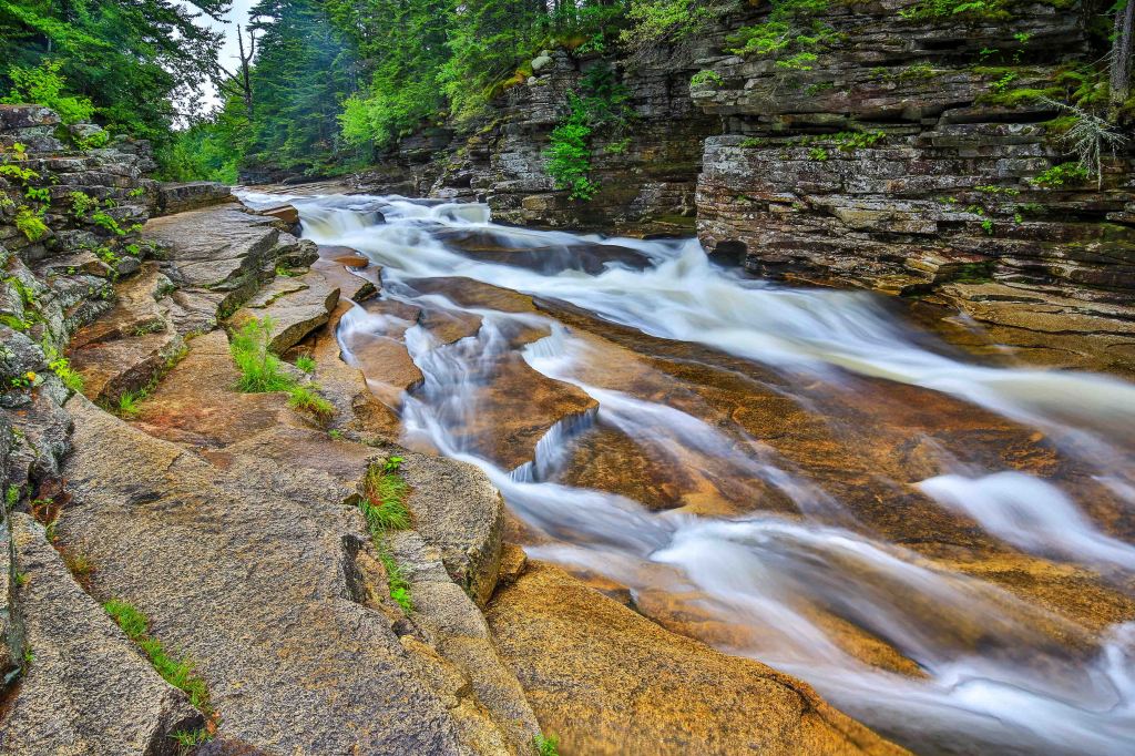
Lower Ammonoosuc Falls
A popular swimming hole, it can be tough to photograph without the crowds. As I said above, I chose a rainy day when no one was very eager to get in the water.
Paddling
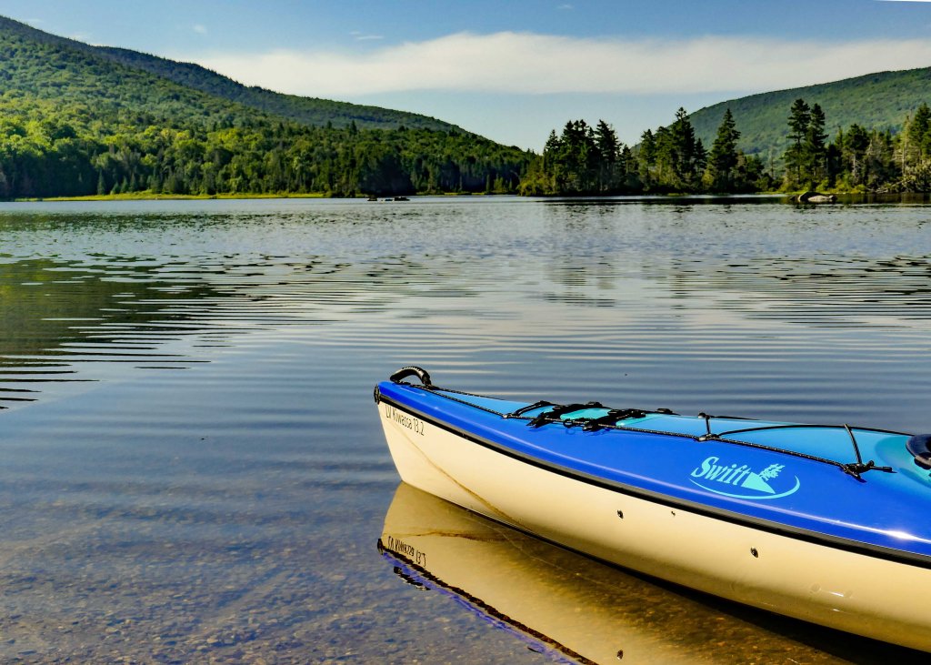
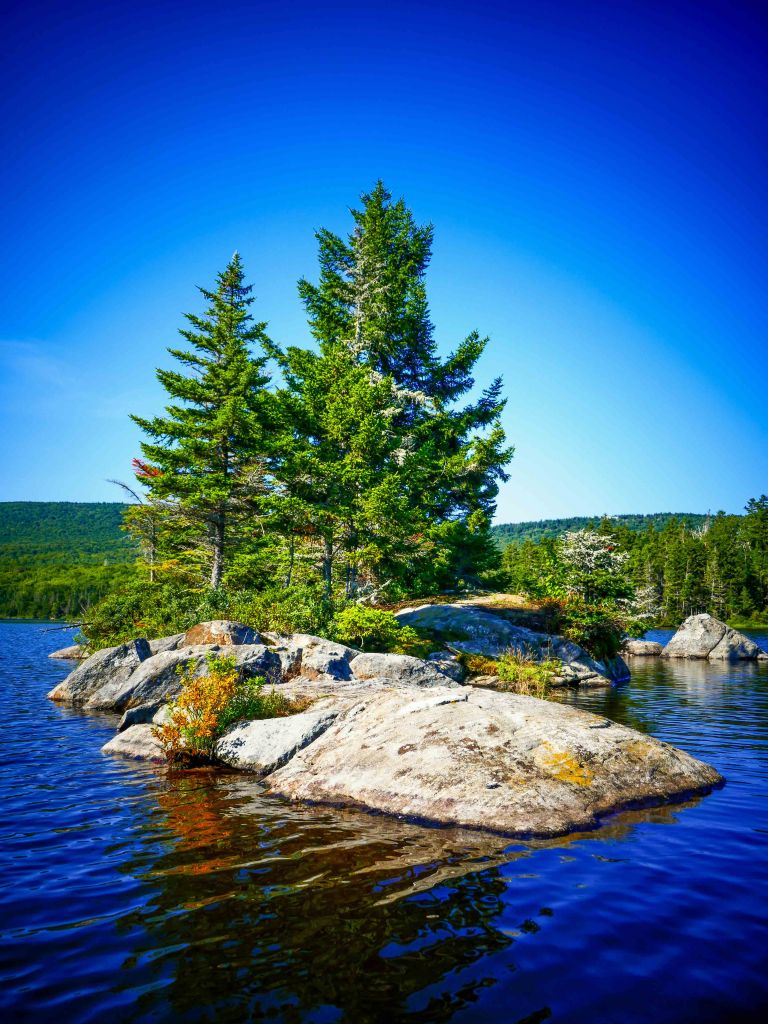
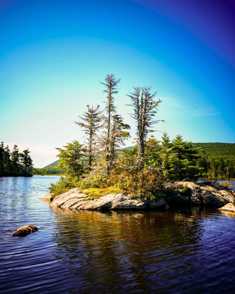
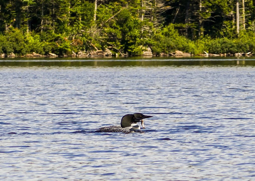
Long Pond
Long Pond, 1-mile long and 1/4-mile wide, situated in the White Mountain National Forest of New Hampshire is this secluded pond. Perfect for a quiet early morning or evening paddle offering solitude for reflection. During the day, take the time to dip your toes in the cool water and enjoy the many opportunities to enjoy the shoreline. It is in fact long: a mile long and a 1/4 mile wide.
We visited in the height of summer and only saw a couple of other paddlers. Despite it being somewhat close to the hustle and bustle of the Whites it is removed enough from the touristy areas of the Kancamagus Highway and Franconia Notch crowds that it will likely be quiet when you visit.
In Closing
That about covers our short stay on the North side of The Notch. We will be back for more adventures in New Hampshire. But for now, our next move was into Maine for adventures along the Coast and Acadia National Park.
Follow us along at:
Instagram: @nspiredadventuresblog
Facebook: Nspired Adventures (Page)
Fine Art America: Nspired Eye Photography
RV Life Campground Reviews: https://campgrounds.rvlife.com/profile/212086
Email: nspiredadventures2020@gmail.com
