

A little further North to Fort Payne, Alabama
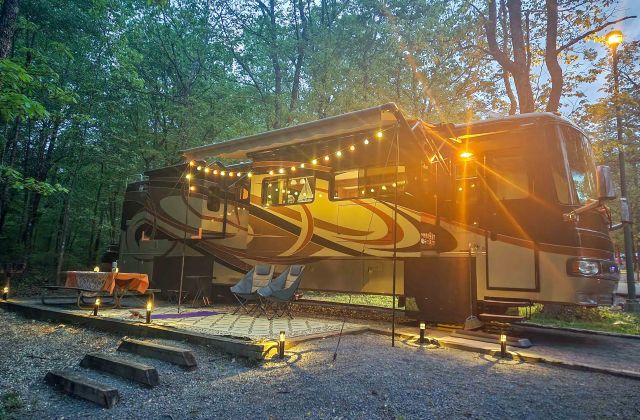
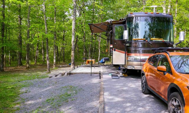
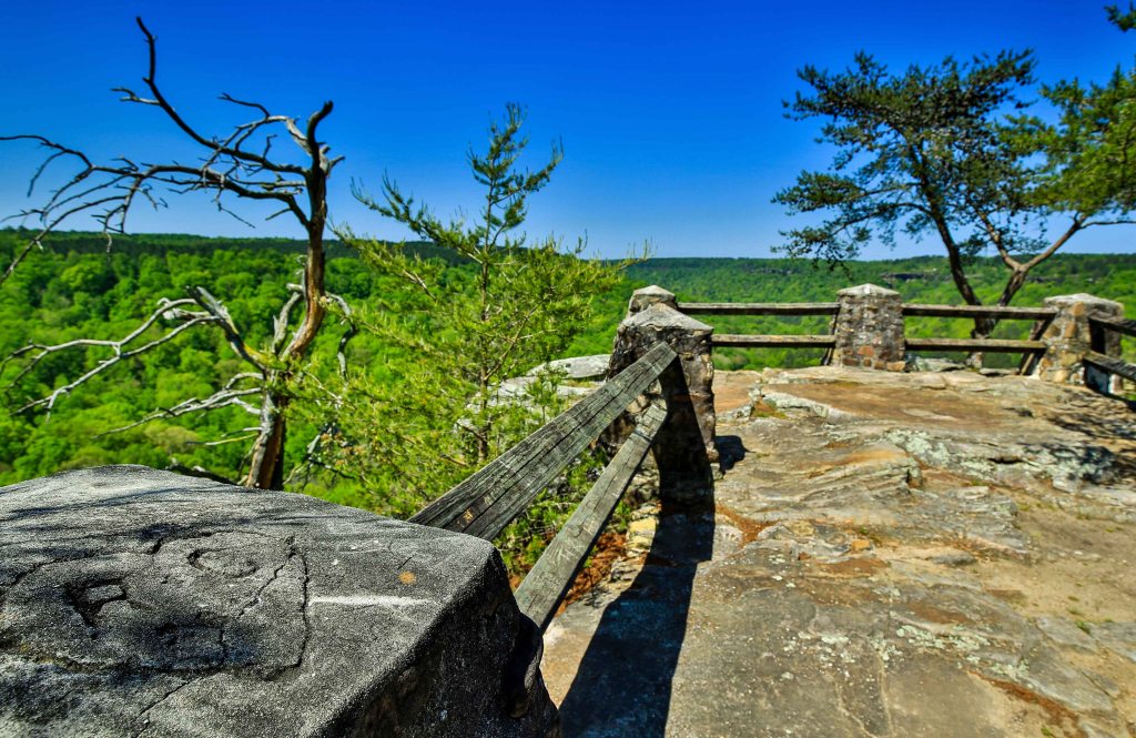
Our next stop heading north is DeSoto State Park in Fort Payne, Alabama. A little mountain town that is the home of a the country singing group, Alabama and some of the state’s most beautiful natural attractions. We will enjoy this newly renovated campground nestled atop beautiful Lookout Mountain for some kayaking, hiking, scenic drives and waterfall chasing.
The Park
Developed in the late 1930s, the hard-working and dedicated men of the CCC made many natural enhancements to the DeSoto State Park that have withstood the test of time and will last for future generations.
Things we did in the Park:
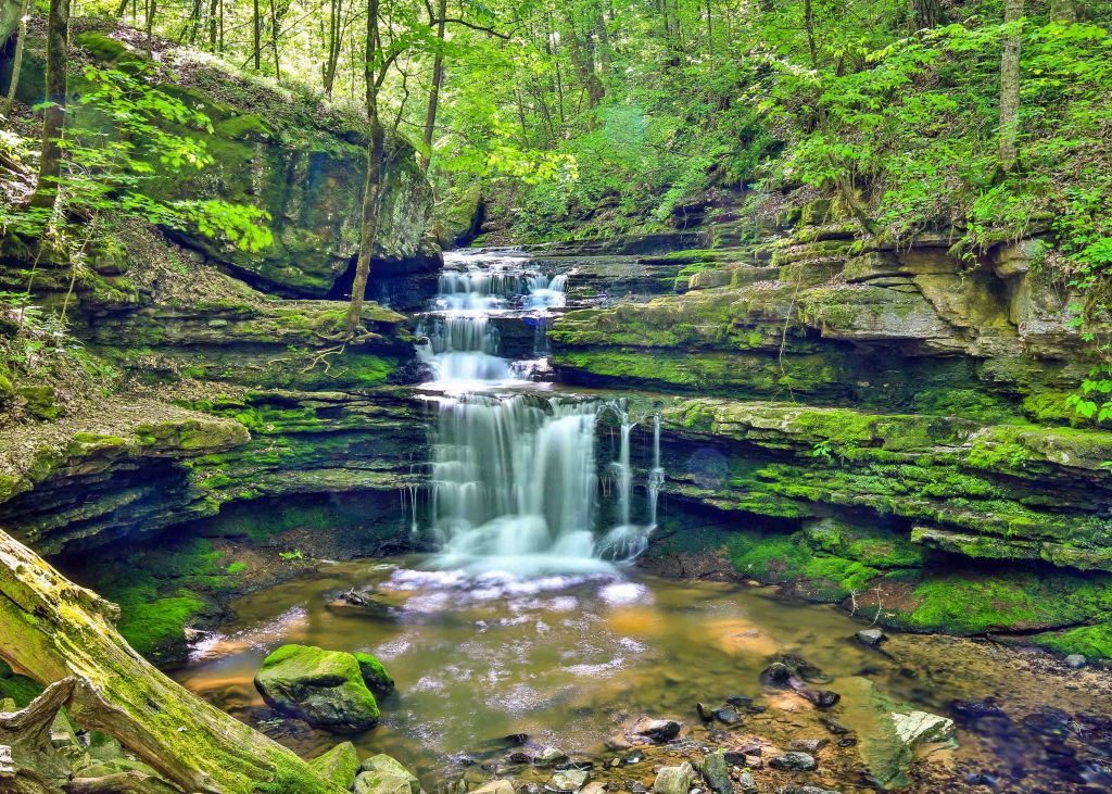
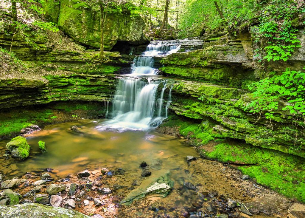
DeSoto Falls
“As long as I live, I’ll hear waterfalls and birds and winds sing. I’ll interpret the rocks, learn the language of flood, storm, and the avalanche. I’ll acquaint myself with the glaciers and wild gardens, and get as near the heart of the world as I can.”
– John Muir
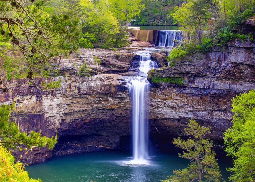
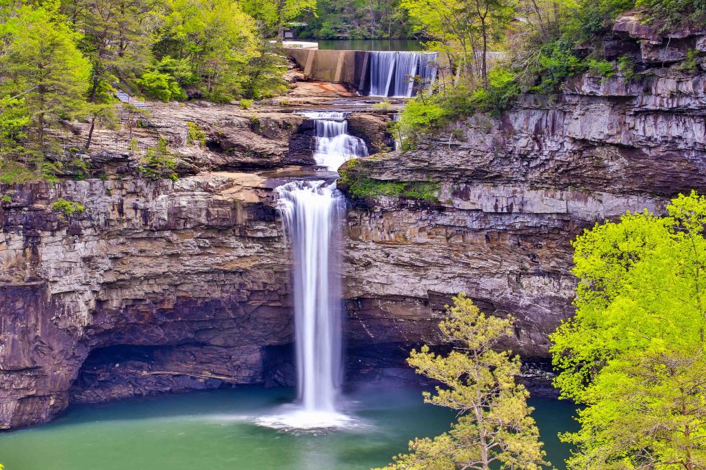
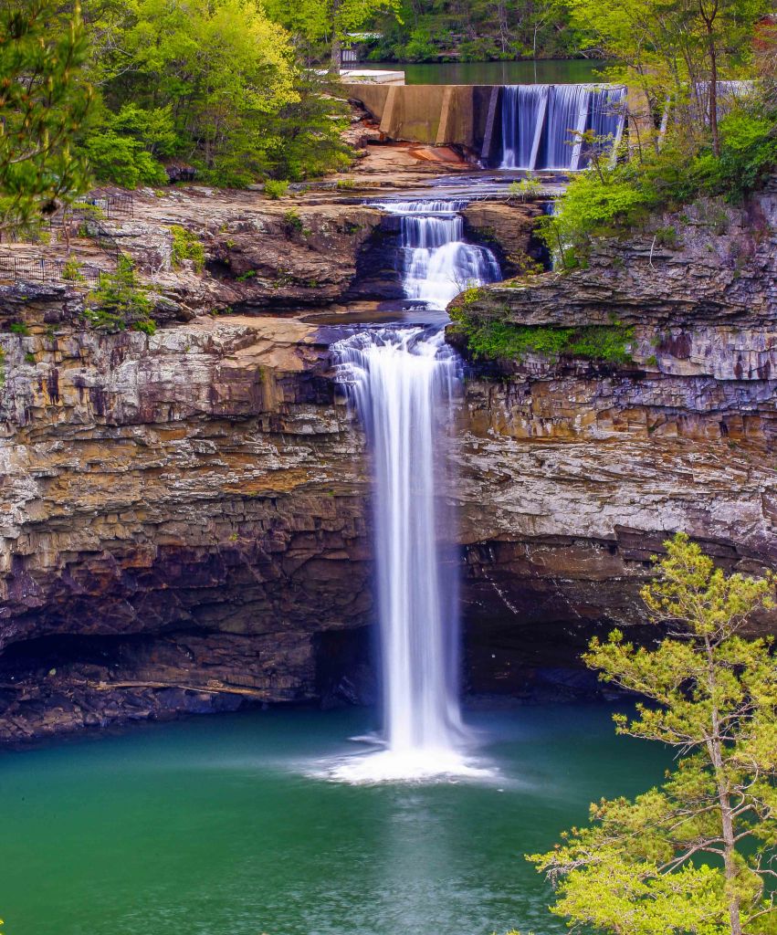
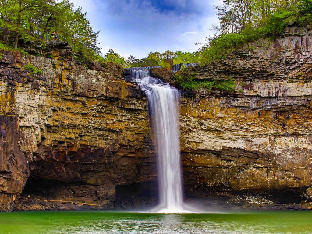
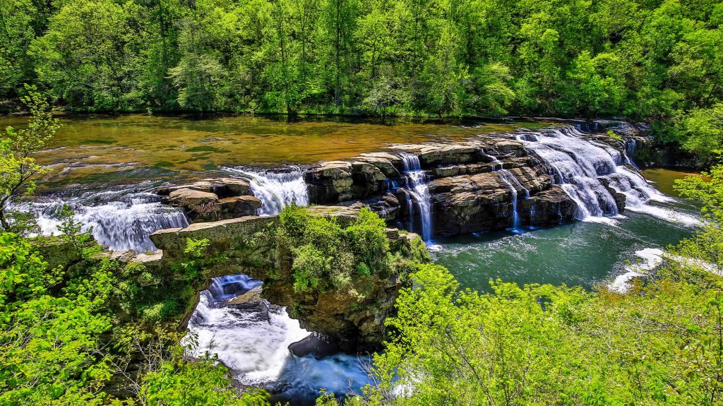
DeSoto Falls, a 107-foot natural wonder located on the West Fork of the Little River near Mentone, Alabama. Rightfully so, this is one of the most photographed points of interest in Alabama, and most visited waterfall locations in the state.
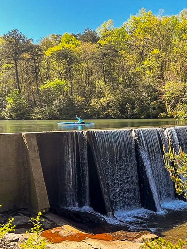
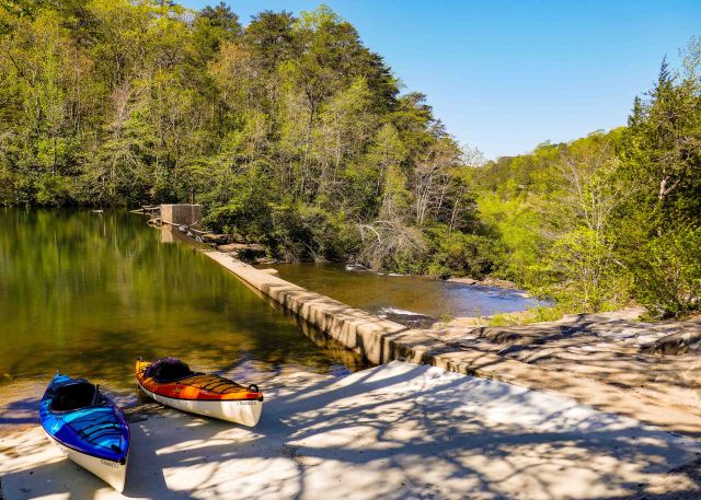
Sitting just above the falls is the A. A. Miller Dam, a concrete dam which was built in 1925 for Alabama’s first hydroelectric power plant, which is of historical significance.
You are able to view in a couple of different ways:
- Drive to the DeSoto Falls Picnic Area and pay the minimal $4 fee to park. From there you take the a paved pathway that leads a few hundred yards from the parking lot, down approximately 50 steps, to the railed overlook.
- The historic A. A. Miller Dam & the Upper Falls can be seen by visitors of all abilities, but the lower or main waterfall requires a walk down 50 concrete stairs to the overlook.
- From this picnic area you will also be able to enjoy a sandy beach, picnic tables or grassy spot by the shore of the West Fork of the Little River.
- Rent or bring your own kayak to paddle the 2.5-miles to another dam that abuts Private Property so at this point we turned around and headed back to the picnic area to enjoy our lunch in the shade by the river.
- You will also have access to restroom and a snack bar during operating hours. Check with the park to determine what those hours might be.
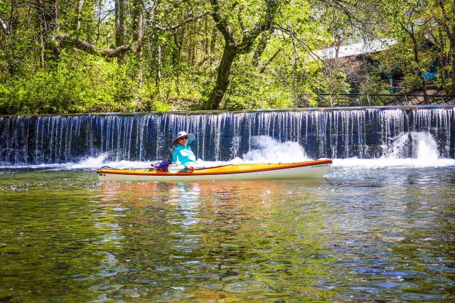
2. To view the falls from the front and unarguably the most dramatic of the views, you will need to hike the DeSoto Falls River Trail. You will reach the trailhead just before the Picnic Area on your right. From there there are three different trails that all combined make up about 2.5-miles. We first did the Overlook Trail, then we backtracked to take the River Trail to the base and then we opted for the Bluff Trail on the way back to the car. It is a well marked system with detailed instruction at the trailhead kiosk or on a map you can obtain at the visitor’s center.
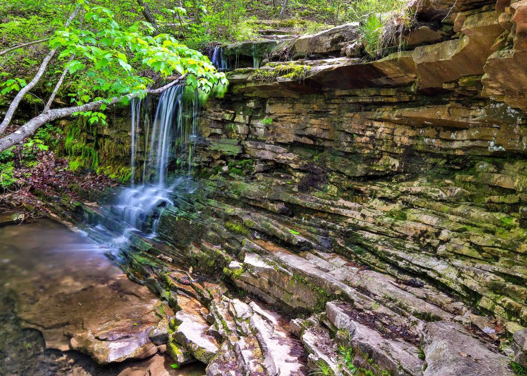
Hiking
Laurel Falls and Lost Falls Trails Loop
Per the All Trails route, we started this lovely walk in the woods at the Talmadge Butler Boardwalk and followed the Red Trail, Orange Trail and finally the Blue Trail to the Visitor Center for a cold drink and to sit on the porch a spell. Then we were back in our car for the short drive “home”.
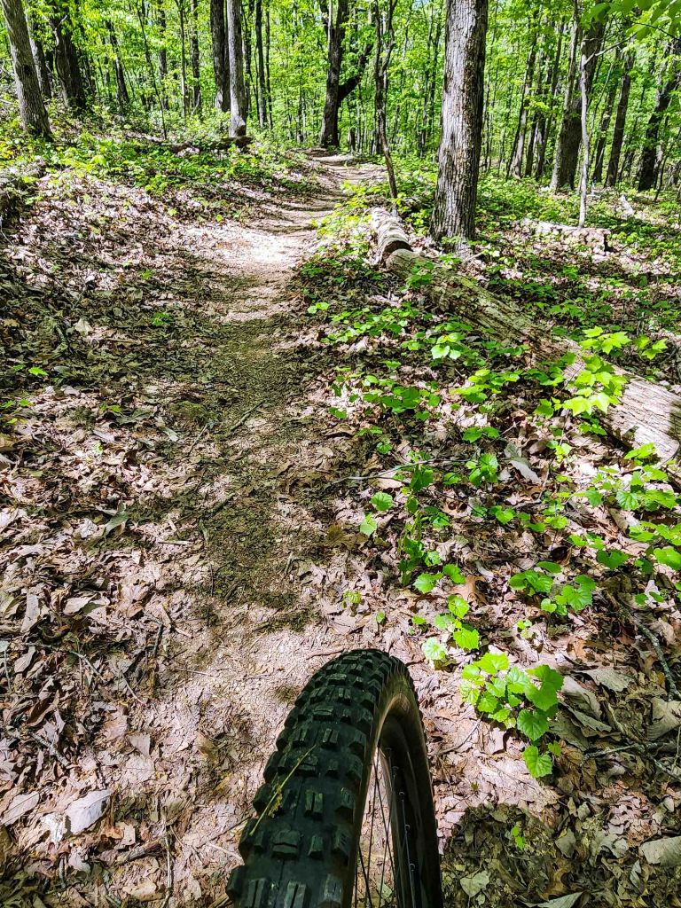
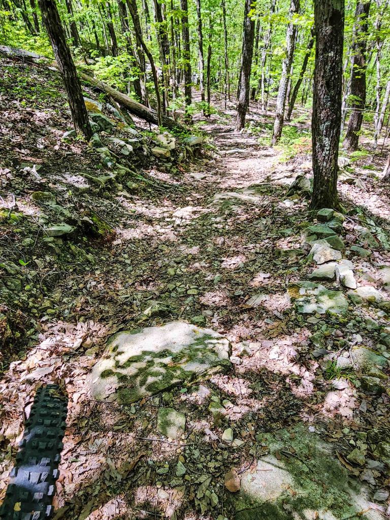
Biking
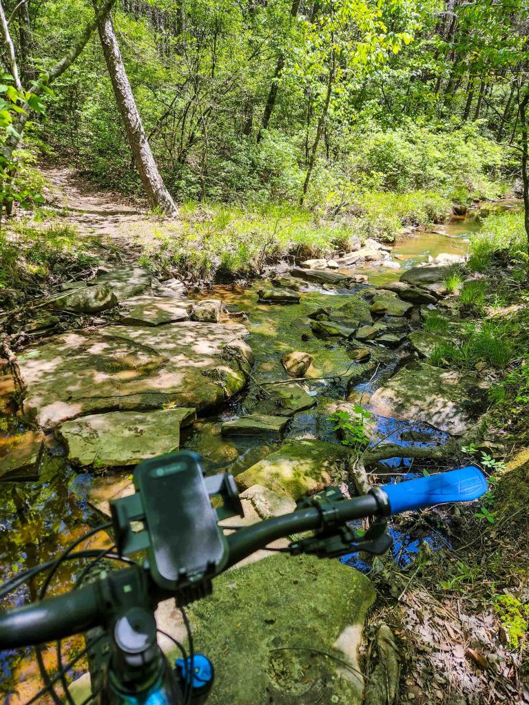
Mike took a few hours to explore the off-road/mountain biking trails. I’m still hesitant to take the dirt paths since my wrist incident in New Hampshire last year so I sat this adventure out. But according to Mike, there are over 20 miles of bike trails with lots of variety such as rocks, roots, hills or fast and flowy.
Of Interest in the Area:
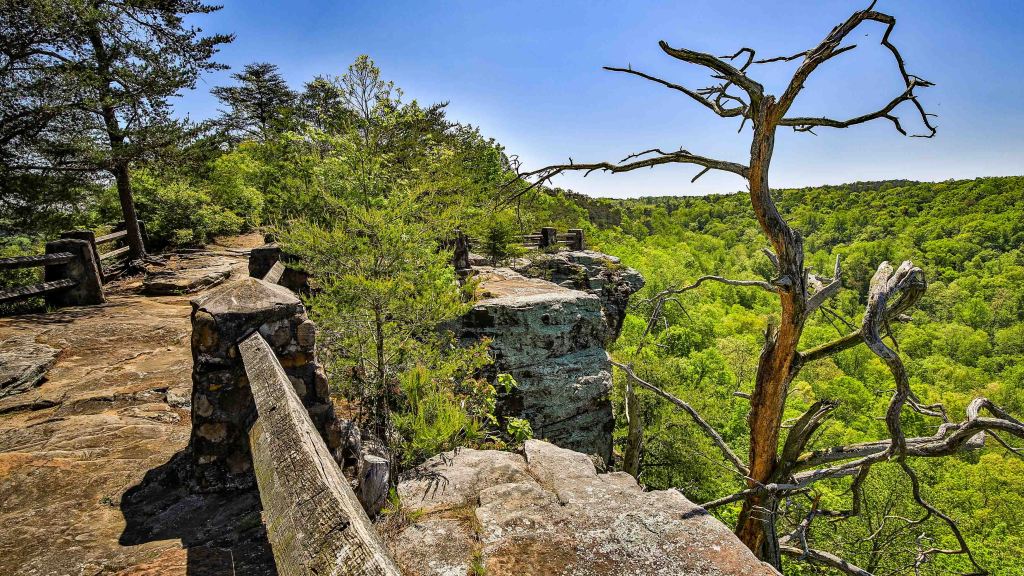
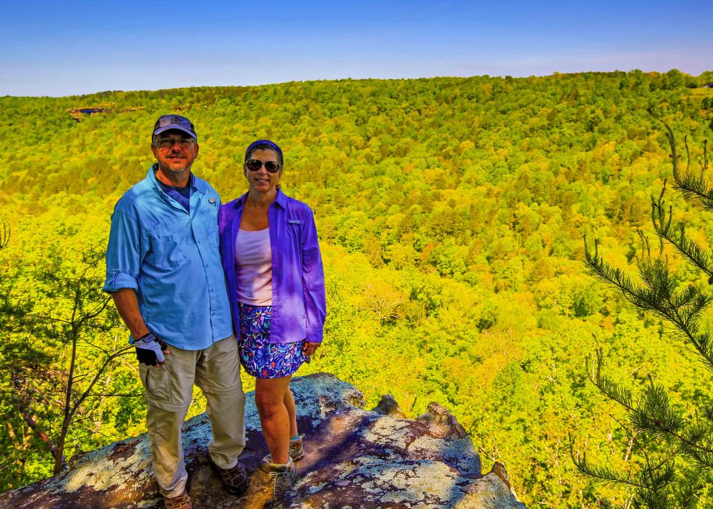
Little River Canyon National Preserve
Little River Canyon National Preserve was established in 1992 to protect the landscapes of the Little River Canyon. Protected within the 15,288-acre preserve boundary are the spectacular Little River Canyon, the pristine Little River, and a number of rare and threatened plant and animal species. Together with the adjacent Desoto State Park, Little River Canyon National Preserve provides abundant scenic views and varied recreational opportunities for locals and visitors alike.
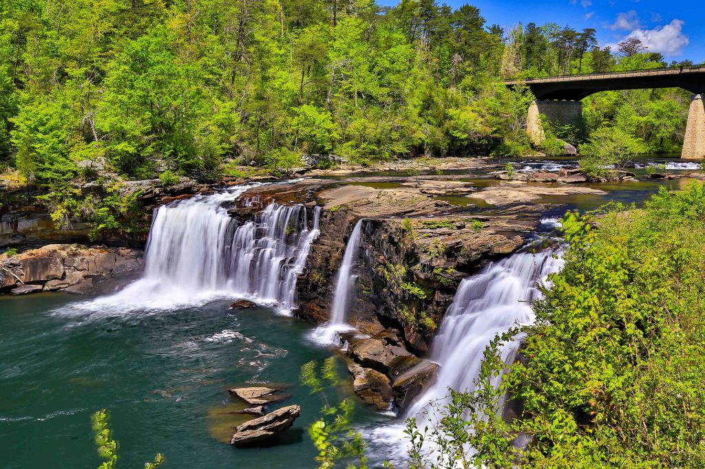
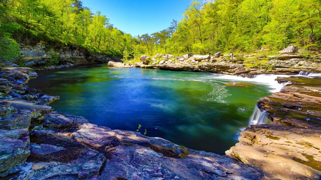
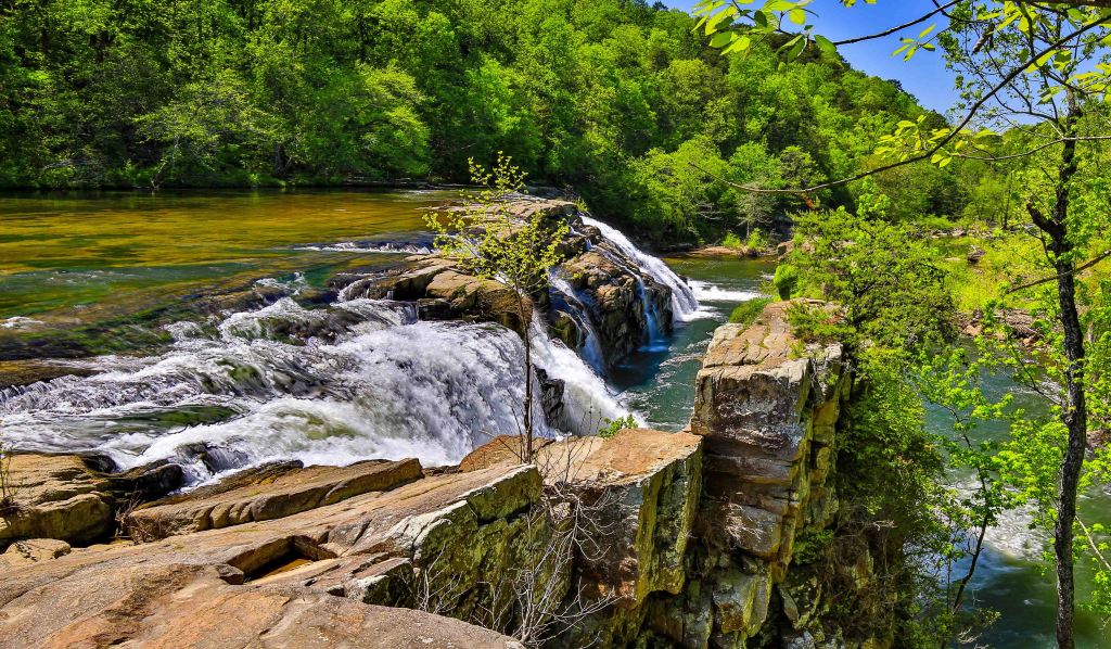
Little River Falls and Canyon
We saved this jewel for a Saturday in April when there were a lot of other visitors soaking up the sunshine on this spectacular day. Luckily, we set out at 8 AM to start our day and were the first to arrive at the parking lot for the Little River Canyon Falls. After stopping at the overlook to admire the the most popular feature, Little River Falls. At 45 feet high, it is quite spectacular.
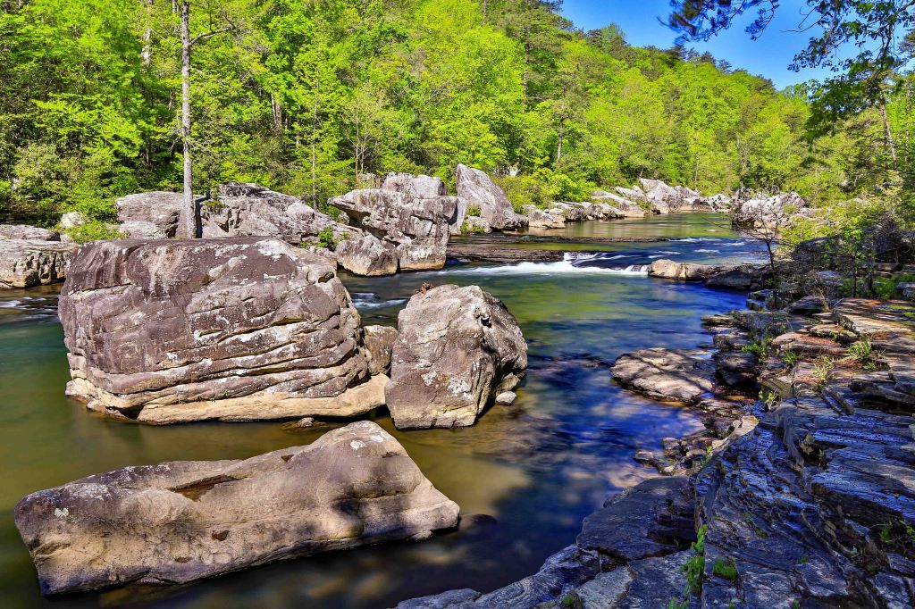
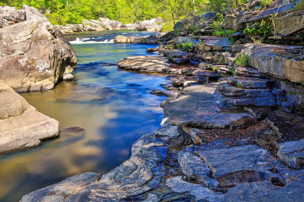
We then headed down the Little River Canyon trail, a .75 mile hike which leads to 137 stone stairs down into the canyon for photographic opportunities of Little Falls and the sandstone ledges within the canyon.
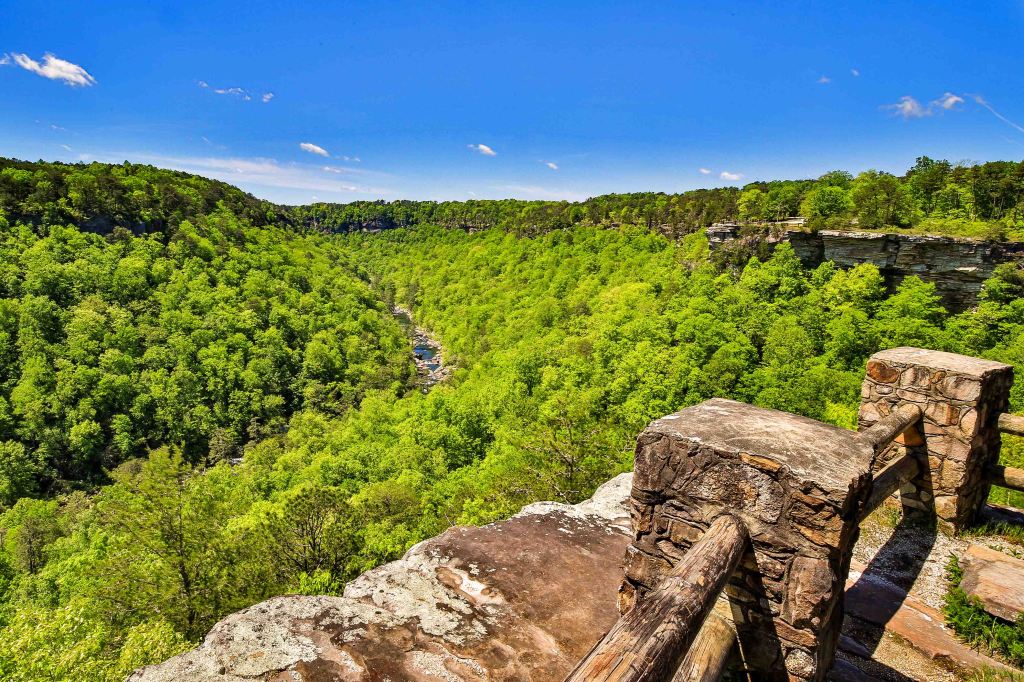
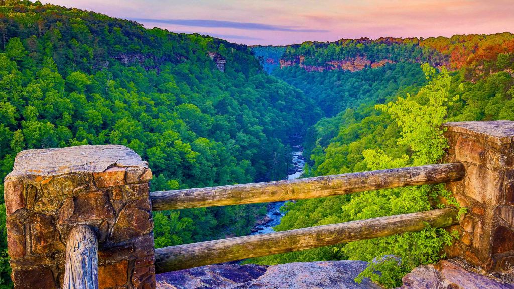
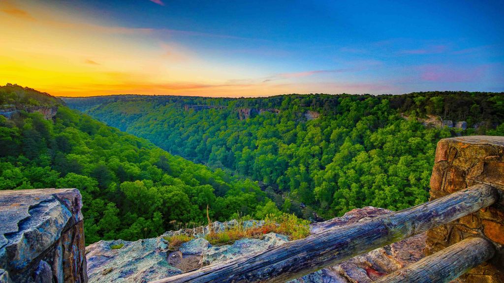
Little River Canyon Scenic Drive
The 11-mile scenic drive begins at the Little River Falls Boardwalk Overlook and ends at Eberhart Point Overlook. The Scenic drive has many overlooks that allows visitors to view the splendor of the canyon with very little walking required.
Buck’s Pocket State Park
Located in three counties (DeKalb, Jackson and Marshall) and secluded in a natural pocket, Bucks Pocket State Park is Alabama’s most underrated state park. It is a very peaceful & tranquil places featuring two scenic, cliff-lined gorges: Little Sauty Creek and South Sauty Creek.
The park’s best-known trail, the Point Rock Trail, follows Little Sauty Creek through numerous mossy boulder fields and woods.
Our adventure started at the Point Rock Trail Head just outside the campground to Little Sauty Creek Falls, a very scenic 15-foot cascade. The creek spills over a series of ledges and into a small pool.
After a bit of time admiring and photographing the falls, we took the trail up to the Jim Lynn Overlook. We admired the view from1,000-foot scenic overlook, found some shade to eat our packed lunch and then decided to trek the road back to the car. This was a good choice for us as it was quick and because we didn’t see another sole or vehicle. We felt like we were still in the woods without having to contend with the steep rocky downhill.
High Falls Park
Our next stop was a mere 5-mile drive to High Falls Park. The centerpiece of High Falls Park is the 35-feet waterfall. Formed by Town Creek, the falls span some 300 feet across at times.
We caught this warm weather attraction on a mild-temp Wednesday in April so we didn’t encounter too many other humans with our short stay. We were greeted warmly upon arrival and check-in at the Visitor Center. We walked the short paved trail to the picnic table and followed the fence to an overlook. We weren’t willing to take the rugged trail to the bottom so we opted to take the scenic route to the top of the falls. We took some time to dip our toes in the water then we were on our way.
In Closing
We enjoyed our visit to Fort Payne, Alabama. We left a few things unexplored. We failed to hit the Alabama Fan Club & Museum, we didn’t walk the historic area of the town, and we didn’t try some of the local favorite restaurants. Maybe next time.
Stay tuned for lots of posts and more importantly….. photographs by James Frazier (aka Mike).
Dream Big….Travel Far….Live Well
Photography
Many of these highlighted photographs can be purchased through our website and made into wall art, tapestries, t-shirts and more. If you see something you like without a link, please go here to our Alabama website page Nspired Eye Photography
Follow along with us at:
Instagram: @nspiredadventures
Facebook: Nspired Adventures (Page)
Fine Art America: Nspired Eye Photography
RV Life Campground Reviews: https://campgrounds.rvlife.com/profile/212086
Email: nspiredadventures2020@gmail.com
